Arenig Fawr South Ridge Top
Arenig Fawr South Ridge Top is a top of Arenig Fawr in southern Snowdonia, North Wales. It lies in area of rocky knolls and small tarns, found on the broad south ridge of Arenig Fawr.
| Arenig Fawr South Ridge Top | |
|---|---|
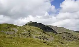 Arenig Fawr South Ridge Top from the south | |
| Highest point | |
| Elevation | 712 m (2,336 ft) |
| Prominence | 18 m (59 ft) |
| Parent peak | Arenig Fawr |
| Listing | Nuttall |
| Naming | |
| English translation | Great High Ground |
| Language of name | Welsh |
| Pronunciation | Welsh: [aˈrɛnɪɡ ˈvaur] |
| Geography | |
| Location | Gwynedd, Wales |
| Parent range | Snowdonia |
| OS grid | SH827370 |
| Topo map | OS Landranger 124 |
The summit, marked by a few stones, is a top of the highest rocky outcrop found in the area. The views are limited, blocked by the bulk of Arenig Fawr. A path leads down the west flank of the ridge towards Moel Llyfnant.[1]
References
- Nuttall, John; Nuttall, Anne (2003). The Mountains of England and Wales: Wales. Cicerone Press Limited. ISBN 978-1-85284-304-5.
This article is issued from Wikipedia. The text is licensed under Creative Commons - Attribution - Sharealike. Additional terms may apply for the media files.