Çukurca
Çukurca (Kurdish: Çel,[3] Syriac: ܛܝܵܪܹܐ, romanized: Ṭyārē)[4] is a district of the Hakkâri Province of Turkey, close to Iraq. The mayor is Ensar Dündar (AKP).[5] The population is 5283 as of 2010.
Çukurca | |
|---|---|
%252C_village_G%C3%BCnde%C5%9F_near_%C3%87ukurca.jpg.webp) Assyrian Church of the East in Çukurca | |
 Çukurca | |
| Coordinates: 37°15′02″N 43°37′00″E | |
| Country | |
| Province | Hakkâri |
| Government | |
| • Mayor | Ensar Dündar (AKP) |
| • Kaymakam | Levent Öztin |
| Area | |
| • District | 908.79 km2 (350.89 sq mi) |
| Elevation | 1,285 m (4,216 ft) |
| Population (2012)[2] | |
| • Urban | 8,247 |
| • District | 15,294 |
| • District density | 17/km2 (44/sq mi) |
| Post code | 30700 |
| Website | www.cukurca.bel.tr |
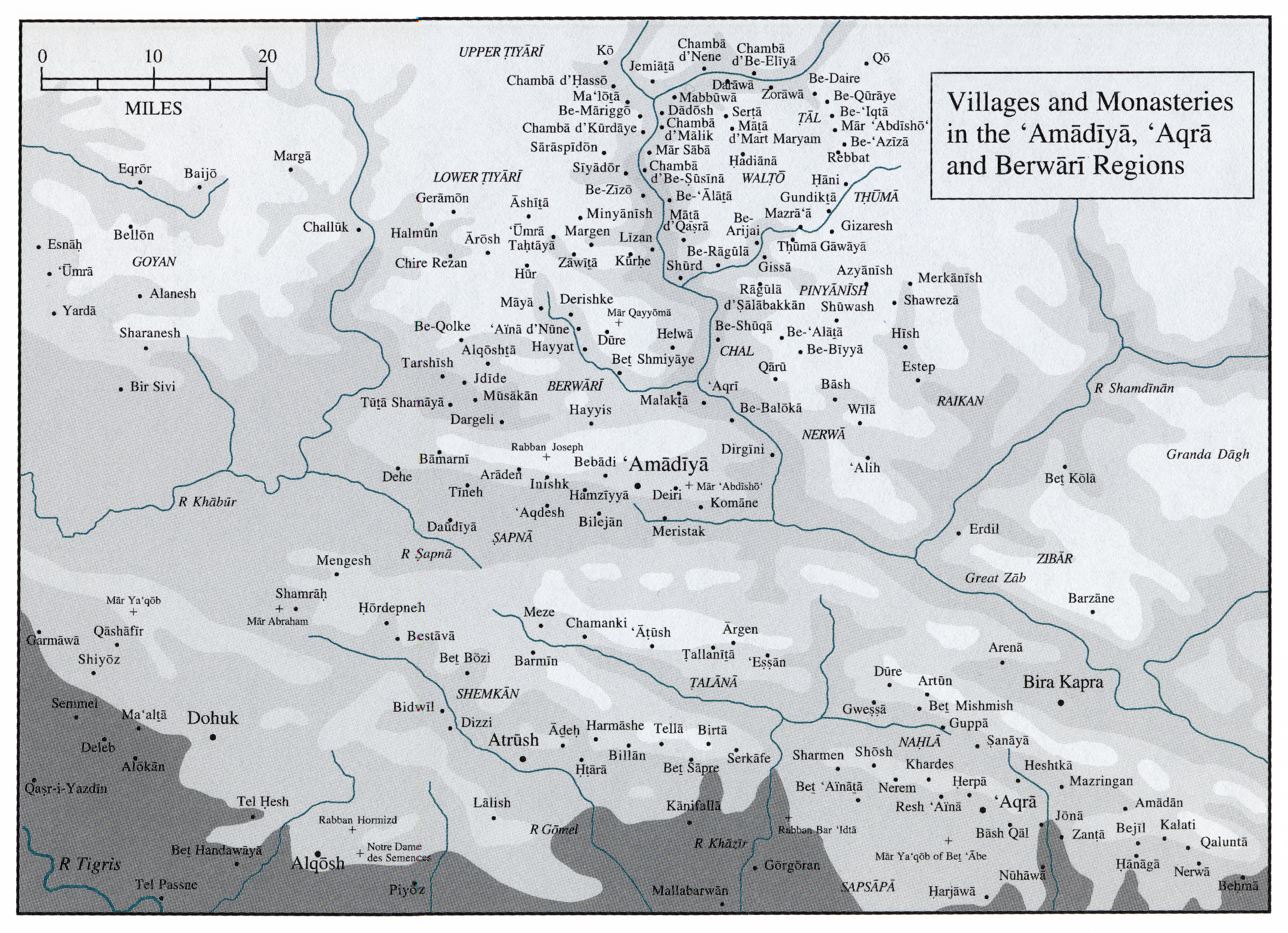
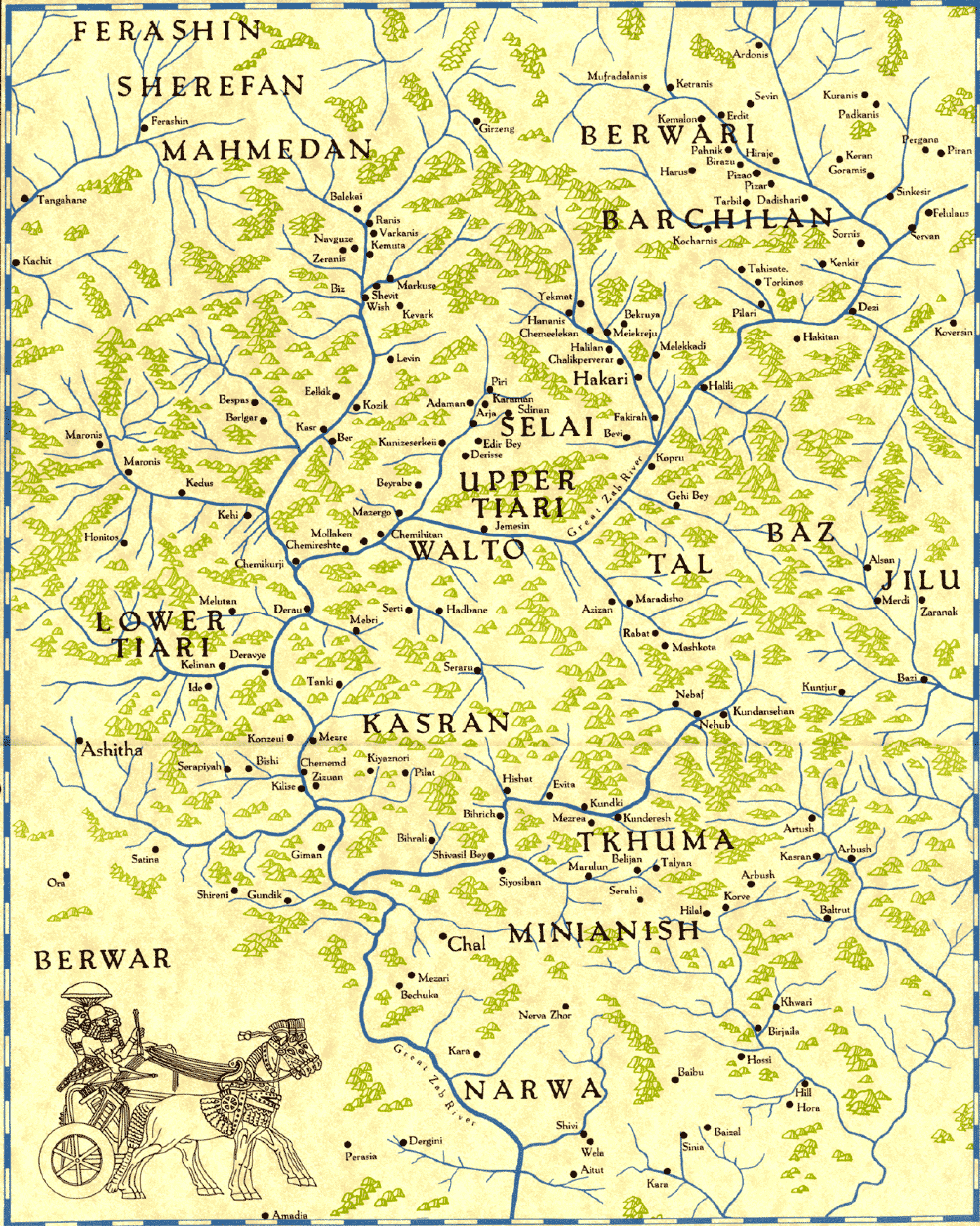
The historical Assyrian tribe of Tyari was located in this district until the Assyrian genocide.[6][7][8]
In 2011 it had a battle take place between the PKK and Turkish soldiers.[9]
Climate
Çukurca has a hot-summer subtype (Köppen: Dsa) of the humid continental climate.
| Climate data for Çukurca | |||||||||||||
|---|---|---|---|---|---|---|---|---|---|---|---|---|---|
| Month | Jan | Feb | Mar | Apr | May | Jun | Jul | Aug | Sep | Oct | Nov | Dec | Year |
| Average high °C (°F) | 4.1 (39.4) |
5.7 (42.3) |
10.2 (50.4) |
16.0 (60.8) |
23.3 (73.9) |
29.9 (85.8) |
34.5 (94.1) |
34.4 (93.9) |
30.4 (86.7) |
22.6 (72.7) |
13.6 (56.5) |
6.4 (43.5) |
19.3 (66.7) |
| Daily mean °C (°F) | 0.0 (32.0) |
1.3 (34.3) |
5.5 (41.9) |
10.9 (51.6) |
17.3 (63.1) |
23.0 (73.4) |
27.4 (81.3) |
27.2 (81.0) |
23.1 (73.6) |
16.2 (61.2) |
8.6 (47.5) |
2.5 (36.5) |
13.6 (56.5) |
| Average low °C (°F) | −4.0 (24.8) |
−3.0 (26.6) |
0.9 (33.6) |
5.9 (42.6) |
11.3 (52.3) |
16.2 (61.2) |
20.3 (68.5) |
20.0 (68.0) |
15.8 (60.4) |
9.9 (49.8) |
3.7 (38.7) |
−1.3 (29.7) |
8.0 (46.4) |
| Average precipitation mm (inches) | 111 (4.4) |
146 (5.7) |
142 (5.6) |
131 (5.2) |
59 (2.3) |
2 (0.1) |
1 (0.0) |
1 (0.0) |
3 (0.1) |
41 (1.6) |
98 (3.9) |
108 (4.3) |
843 (33.2) |
| Source: Climate-Data.org[10] | |||||||||||||
See also
- Ortaköy, Uludere, a nearby Assyrian village (Geramon) in Sirnak Province
- List of Assyrian settlements
References
- "Area of regions (including lakes), km²". Regional Statistics Database. Turkish Statistical Institute. 2002. Retrieved 2013-03-05.
- "Population of province/district centers and towns/villages by districts - 2012". Address Based Population Registration System (ABPRS) Database. Turkish Statistical Institute. Retrieved 2013-02-27.
- adem Avcıkıran (2009). Kürtçe Anamnez Anamneza bi Kurmancî (PDF) (in Turkish and Kurdish). p. 56. Retrieved 17 December 2019.
- Maclean, Arthur John (1895). Grammar of the Dialects of Vernacular Syriac. Cambridge: Cambridge University Press. p. 241.
- "Hakkari Çukurca Seçim Sonuçları - 31 Mart 2019 Yerel Seçimleri". www.sabah.com.tr. Retrieved 2019-09-12.
- Tribal Structure.
- "map: villages and monasteries". www.aina.org.
- Assyrian villages in Hakkari
- "2011 Hakkâri attack", Wikipedia, 2022-02-06, retrieved 2022-03-01
- "Climate:Çukurca". Climate-Data.org. Retrieved 11 April 2014.
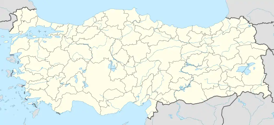
Çukurca in Hakkâri Province of Turkey | |||||||||||||||||||||||||||
|---|---|---|---|---|---|---|---|---|---|---|---|---|---|---|---|---|---|---|---|---|---|---|---|---|---|---|---|
| Districts |  Districts of Hakkâri | ||||||||||||||||||||||||||
| |||||||||||||||||||||||||||
Metropolitan municipalities are bolded. | |||||||||||||||||||||||||||
This article is issued from Wikipedia. The text is licensed under Creative Commons - Attribution - Sharealike. Additional terms may apply for the media files.