Émiéville
Émiéville (French pronunciation: [emjevil] (![]() listen)) is a commune in the Calvados department in the Normandy region in northwestern France.
listen)) is a commune in the Calvados department in the Normandy region in northwestern France.
Émiéville | |
|---|---|
 The church in Émiéville | |
Location of Émiéville 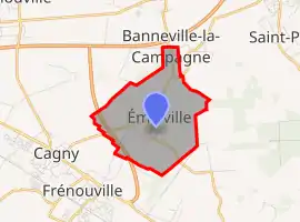 | |
 Émiéville  Émiéville | |
| Coordinates: 49°09′07″N 0°13′22″W | |
| Country | France |
| Region | Normandy |
| Department | Calvados |
| Arrondissement | Caen |
| Canton | Troarn |
| Intercommunality | Val ès Dunes |
| Government | |
| • Mayor (2020–2026) | Stéphane Amilcar[1] |
| Area 1 | 3.92 km2 (1.51 sq mi) |
| Population | 618 |
| • Density | 160/km2 (410/sq mi) |
| Time zone | UTC+01:00 (CET) |
| • Summer (DST) | UTC+02:00 (CEST) |
| INSEE/Postal code | 14237 /14630 |
| Elevation | 4–22 m (13–72 ft) (avg. 11 m or 36 ft) |
| 1 French Land Register data, which excludes lakes, ponds, glaciers > 1 km2 (0.386 sq mi or 247 acres) and river estuaries. | |
Population
| Year | Pop. | ±% |
|---|---|---|
| 1962 | 237 | — |
| 1968 | 198 | −16.5% |
| 1975 | 255 | +28.8% |
| 1982 | 280 | +9.8% |
| 1990 | 356 | +27.1% |
| 1999 | 349 | −2.0% |
| 2008 | 473 | +35.5% |
See also
References
- "Répertoire national des élus: les maires". data.gouv.fr, Plateforme ouverte des données publiques françaises (in French). 9 August 2021.
- "Populations légales 2019". The National Institute of Statistics and Economic Studies. 29 December 2021.
| Wikimedia Commons has media related to Émiéville. |
This article is issued from Wikipedia. The text is licensed under Creative Commons - Attribution - Sharealike. Additional terms may apply for the media files.