Mount Shiretoko
Mount Shiretoko (知床岳, Shiretoko-dake) is a volcano located on the Shiretoko Peninsula in Hokkaidō, Japan. The mountain consists of non-alkali mafic rocks and andesite.[2][3] Mount Shiretoko is in Shari town, in Shari District of Abashiri Subprefecture.
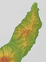
Relief Ma
| Mount Shiretoko | |
|---|---|
| 知床岳 | |
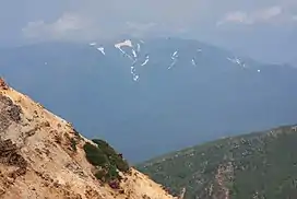 Mt Shiretoko. | |
| Highest point | |
| Elevation | 1,253.9 m (4,114 ft)[1] |
| Prominence | 980 m (3,220 ft)[1] |
| Parent peak | Mount Higashi |
| Listing | List of mountains and hills of Japan by height |
| Coordinates | 44°14′9″N 145°16′26″E[1] |
| Geography | |
 Mount Shiretoko Location of Mount Shiretoko in Japan. | |
| Location | Hokkaidō, Japan |
| Parent range | Shiretoko Peninsula |
| Topo map | Geospatial Information Authority 25000:1 知床岳 50000:1 知床岬 |
| Geology | |
| Age of rock | Middle Pleistocene |
| Mountain type | stratovolcano |
| Volcanic arc/belt | Kurile arc |
| Last eruption | 200,000 years ago |
References
- Geospatial Information Authority topographical map 知床岳
- "Hokkaido". Seamless Digital Geological Map of Japan. Geological Survey of Japan, AIST. 2007. Retrieved 5 May 2010.
- "SHIRETOKO-DAKE". Quaternary Volcanoes of Japan. Geological Survey of Japan, AIST. 2006. Retrieved 5 May 2010.
External links
- Shiretoko Dake - Geological Survey of Japan
- "Shiretoko". Global Volcanism Program. Smithsonian Institution. Retrieved 25 June 2021.
This article is issued from Wikipedia. The text is licensed under Creative Commons - Attribution - Sharealike. Additional terms may apply for the media files.