National Highway 52 (India)
National Highway 52 (NH 52), Sangrur, Punjab to Ankola, Karnataka , is a National Highway in India.[1] The national highway 52 was numbered after amalgamating many existing national highways of India. The old highway numbered NH-63 was from Ankola in Karnataka state to Gooty in Andhra pradesh state.[2] The highway 52 starts at the junction of National Highway 66 (old number NH-17) at Ankola and moves up to Arebail ghat of Western ghats and then to Yellapura and further to Hubbali (Hubli).[3] Some stretch of old national highway 13 from Vijayapura ( old name Bijapur) to Solapur was joined with NH-52.
 | |
|---|---|
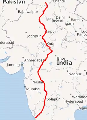 National Highway 52 in Red on India map | |
.jpg.webp) Schematic map of National Highways in India | |
| Route information | |
| Part of | |
| Length | 2,317 km (1,440 mi) |
| Major junctions | |
| From | Sangrur, Punjab |
| To | Ankola, Karnataka |
| Location | |
| Country | India |
| States | Punjab - Haryana - Rajasthan - Madhya Pradesh - Maharashtra - Karnataka |
| Highway system | |
Major cities
Rajasthan
Maharashtra
See also
References
- "Rationalisation of Numbering Systems of National Highways" (PDF). New Delhi: Department of Road Transport and Highways. Archived from the original (PDF) on 31 March 2012. Retrieved 3 April 2012.
- "National Highway 63". Maps of India. Retrieved 5 November 2019.
- "Arebail Ghat". The New Indian Express. Retrieved 30 April 2019.

Secondary routes of National Highway 52 | ||
|---|---|---|
| ||
| Secondary Routes of NH 52 | ||
This article is issued from Wikipedia. The text is licensed under Creative Commons - Attribution - Sharealike. Additional terms may apply for the media files.