Shire of Toodyay
The Shire of Toodyay is a local government area in the Wheatbelt region of Western Australia, beyond the north-eastern limits of the Perth metropolitan area. The Shire covers an area of 1,694 square kilometres (654 sq mi), and its seat of government is the town of Toodyay.
| Shire of Toodyay Western Australia | |||||||||||||||
|---|---|---|---|---|---|---|---|---|---|---|---|---|---|---|---|
.jpg.webp) The Toodyay Council offices | |||||||||||||||
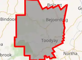
 Location in Western Australia | |||||||||||||||
 | |||||||||||||||
| Population | 4,439 (2016 census)[1] | ||||||||||||||
| • Density | 2.6207/km2 (6.7877/sq mi) | ||||||||||||||
| Established | 1871 | ||||||||||||||
| Area | 1,693.8 km2 (654.0 sq mi) | ||||||||||||||
| Shire President | Rosemary Madácsi | ||||||||||||||
| Council seat | Toodyay | ||||||||||||||
| Region | Wheatbelt | ||||||||||||||
| State electorate(s) | Moore | ||||||||||||||
| Federal division(s) | Pearce | ||||||||||||||
| Website | Shire of Toodyay | ||||||||||||||
| |||||||||||||||
History
The Toodyay Road District was established on 24 January 1871. The Newcastle (later Toodyay) townsite separated as the Municipality of Newcastle on 2 October 1877. The municipality merged back into the road district on 8 March 1912. On 1 July 1961, Toodyay became a shire under the Local Government Act 1960, which reformed all remaining road districts into shires.[2]
Wards
The Shire has been divided into 4 wards, since the Toodyay Road board meeting in June 1904.[3]
- North Ward (2 councillors)
- Central Ward (2 councillors)
- West Ward (3 councillors)
- East Ward (2 councillors)
Towns and localities
- Toodyay
- Bailup
- Bejoording
- Coondle
- Culham
- Dewars Pool
- Dumbarton
- Hoddys Well
- Julimar
- Moondyne
- Morangup
- Nardie
- Nunile
- Wattening
- West Toodyay
Presidents
Population
| Year | Population |
|---|---|
| 1911 | 1,480 |
| 1921 | 1,545 |
| 1933 | 1,462 |
| 1947 | 1,237 |
| 1954 | 1,525 |
| 1961 | 1,369 |
| 1966 | 1,388 |
| 1971 | 1,725 |
| 1976 | 1,138 |
| 1981 | 1,450 |
| 1986 | 1,831 |
| 1991 | 2,451 |
| 1996 | 3,186 |
| 2001 | 3,744 |
| 2006 | 4,112 |
| 2011 | 4,387 |
| 2016 | 4,439 |
Heritage-listed places
As of 2021, 173 places are heritage-listed in the Shire of Toodyay,[4] of which 16 are on the State Register of Heritage Places.[5]
See also

- Wikipedia:WikiTown/Toodyaypedia
References
- Australian Bureau of Statistics (27 June 2017). "Toodyay (S)". 2016 Census QuickStats. Retrieved 28 October 2019.
- "Municipality Boundary Amendments Register" (PDF). Western Australian Electoral Distribution Commission. Retrieved 11 January 2020.
- "Newcastle". Western Mail (Perth, WA : 1885 - 1954). Perth, WA: National Library of Australia. 4 June 1904. p. 18. Retrieved 4 March 2014.
- "Shire of Toodyay Heritage Places". inherit.stateheritage.wa.gov.au. Heritage Council of Western Australia. Retrieved 27 March 2021.
- "Shire of Toodyay State Register of Heritage Places". inherit.stateheritage.wa.gov.au. Heritage Council of Western Australia. Retrieved 27 March 2021.