Wyoming Highway 256
Wyoming Highway 256 (WYO 256) is a 2.67-mile-long (4.30 km) state road in Evansville, Wyoming, just east of Casper known as Cole Creek Road.
 | ||||
|---|---|---|---|---|
| Cole Creek Road | ||||
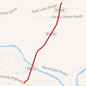 WYO 256 highlighted in red | ||||
| Route information | ||||
| Maintained by WYDOT | ||||
| Length | 2.67 mi[1] (4.30 km) | |||
| Major junctions | ||||
| South end | ||||
| North end | ||||
| Location | ||||
| Country | United States | |||
| State | Wyoming | |||
| Counties | Natrona | |||
| Highway system | ||||
| ||||
| ||||
Route description
Wyoming Highway 256 begins its south end at an intersection with US 20/US 26/US 87 (Glenrock Highway) and the northern terminus of WY 253 in Evansville.[2] The roadway that continues south of US 20/US 26/US 87 is Wyoming Highway 253 (Hat Six Road).[3] Highway 256 travels north for 2.67 miles (4.30 km) northeast towards the mining areas north of the Ednass Kimball Wilkins State Park which is located on US 20/US 26/US 87.[2] The designation of WYO 256 ends and the roadway continues as Natrona CR 701 (Cole Creek Road).[3][4]
Major intersections
The entire route is in Evansville, Natrona County.
| mi | km | Destinations | Notes | ||
|---|---|---|---|---|---|
| 0.0 | 0.0 | Southern Terminus of WYO 255 | |||
| 2.67 | 4.30 | Northern Terminus of WYO 256 | |||
| 1.000 mi = 1.609 km; 1.000 km = 0.621 mi | |||||
References
- Wyoming Department of Transportation Reference Marker Book - November 2004 (PDF) (Map). WYDOT. Archived from the original (PDF) on July 17, 2011. Retrieved 2011-03-31.
- aaroads.com - Wyoming Routes 200-299
- Google (21 December 2016). "Wyoming Highway 256" (Map). Google Maps. Google. Retrieved 21 December 2016.
- WYO 256/CR 701
- Official 2003 State Highway Map of Wyoming
This article is issued from Wikipedia. The text is licensed under Creative Commons - Attribution - Sharealike. Additional terms may apply for the media files.