Xingning, Guangdong
Xingning (postal: Hingning; simplified Chinese: 兴宁; traditional Chinese: 興寧; pinyin: Xīngníng, Hakka: Hinnên) is a county-level city, under the jurisdiction of Meizhou City, Guangdong Province, China. The second largest city in east Guangdong, Xingning has an area of 2,104.85 square kilometres (812.69 sq mi) and a population of 1.13 million.
- Xingning is also the era name for Emperor Ai of the Jin dynasty.
Xingning
兴宁市 Hinnên | |
|---|---|
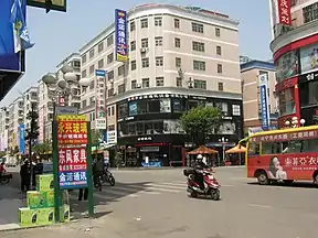 Xingtianyi Road (兴田一路), Xingning | |
 Xingning Location in Guangdong | |
| Coordinates: 24°8′5″N 115°43′48″E | |
| Country | People's Republic of China |
| Province | Guangdong |
| Prefecture-level city | Meizhou |
| Area | |
| • Total | 2,104.85 km2 (812.69 sq mi) |
| Population | |
| • Total | 1,130,000 |
| • Density | 540/km2 (1,400/sq mi) |
| Time zone | UTC+8 (China Standard) |
| Postal code | 514500 |
| Area code(s) | 0753 |
| Website | http://www.xingning.gov.cn/ |
Names
Xingning was formerly known as Qichang (齐昌; 齊昌).
History
Xingning county was established in 331 CE, later becoming the capital of the 10th-century Southern Han Dynasty.
From its previous long-established status a county, in 1991 Xingning was upgraded to a county-level city within the municipal jurisdiction of Meizhou.
Location
Xingning is located in the north eastern part of Guangdong province and borders the counties of Pingyuan, Meixian, Fengshun and Wuhua in Meizhou City; Longchuan in Heiyuan City and Xunwu in Ganzhou City, Jiangxi Province.
Administrative districts
The city governs three subdistricts and 17 towns:[1]
Transport
Culture
The majority of Xingning's residents are Hakka people.
Tourist attractions
- Shenguang Hill
- Xingning Academy
- Heshui Reservoir
Climate
| Climate data for Xingning (1981−2010) | |||||||||||||
|---|---|---|---|---|---|---|---|---|---|---|---|---|---|
| Month | Jan | Feb | Mar | Apr | May | Jun | Jul | Aug | Sep | Oct | Nov | Dec | Year |
| Record high °C (°F) | 28.9 (84.0) |
31.9 (89.4) |
34.2 (93.6) |
35.9 (96.6) |
36.1 (97.0) |
38.3 (100.9) |
38.5 (101.3) |
39.0 (102.2) |
37.4 (99.3) |
35.4 (95.7) |
34.2 (93.6) |
29.3 (84.7) |
39.0 (102.2) |
| Average high °C (°F) | 17.9 (64.2) |
18.8 (65.8) |
21.8 (71.2) |
25.9 (78.6) |
29.2 (84.6) |
31.4 (88.5) |
33.7 (92.7) |
33.3 (91.9) |
31.5 (88.7) |
28.9 (84.0) |
24.5 (76.1) |
19.7 (67.5) |
26.4 (79.5) |
| Daily mean °C (°F) | 12.0 (53.6) |
13.7 (56.7) |
17.0 (62.6) |
21.5 (70.7) |
24.7 (76.5) |
26.9 (80.4) |
28.5 (83.3) |
28.2 (82.8) |
26.4 (79.5) |
23.2 (73.8) |
18.2 (64.8) |
13.2 (55.8) |
21.1 (70.0) |
| Average low °C (°F) | 8.0 (46.4) |
10.2 (50.4) |
13.5 (56.3) |
18.1 (64.6) |
21.3 (70.3) |
23.7 (74.7) |
24.8 (76.6) |
24.7 (76.5) |
22.9 (73.2) |
18.9 (66.0) |
13.7 (56.7) |
8.8 (47.8) |
17.4 (63.3) |
| Record low °C (°F) | −2.5 (27.5) |
0.2 (32.4) |
1.2 (34.2) |
7.5 (45.5) |
13.1 (55.6) |
16.9 (62.4) |
19.2 (66.6) |
21.3 (70.3) |
15.4 (59.7) |
7.7 (45.9) |
1.9 (35.4) |
−3.5 (25.7) |
−3.5 (25.7) |
| Average precipitation mm (inches) | 44.7 (1.76) |
94.4 (3.72) |
135.0 (5.31) |
200.0 (7.87) |
218.3 (8.59) |
241.6 (9.51) |
157.8 (6.21) |
187.0 (7.36) |
132.9 (5.23) |
34.6 (1.36) |
36.0 (1.42) |
35.0 (1.38) |
1,517.3 (59.72) |
| Average relative humidity (%) | 74 | 79 | 80 | 81 | 81 | 82 | 78 | 80 | 79 | 73 | 72 | 72 | 78 |
| Source: China Meteorological Data Service Center | |||||||||||||
References
- "Xingning City (兴宁市)". National Bureau of Statistics of the People's Republic of China. 2013. Retrieved February 26, 2014. (in Chinese)
External links
- Life in Xingning (家在兴宁) (in Chinese)
- Xingning Government website (in Chinese)
- Satellite photo of Xingning from National Geographic
| Sub-provincial cities |
| ||||||||||||||||||||||||||||||||||||||||||||||||||||||||||||||||||||
|---|---|---|---|---|---|---|---|---|---|---|---|---|---|---|---|---|---|---|---|---|---|---|---|---|---|---|---|---|---|---|---|---|---|---|---|---|---|---|---|---|---|---|---|---|---|---|---|---|---|---|---|---|---|---|---|---|---|---|---|---|---|---|---|---|---|---|---|---|---|
| Prefecture-level cities |
| ||||||||||||||||||||||||||||||||||||||||||||||||||||||||||||||||||||