Zaldapa Ridge
Zaldapa Ridge (Bulgarian: рид Залдапа, ‘Rid Zaldapa’ \'rid zal-'da-pa\) is the predominantly ice-free ridge extending 6 km in east-west direction and 1.7 km wide on Yatrus Promontory in Graham Land, Antarctica, with its twin rocky summits rising to 385 (the west one) and 365 m[1] respectively. The feature ends at Jade Point on the east.
The ridge is named “after the ancient Thracian and Roman town of Zaldapa in Northeastern Bulgaria”.[2]
Location
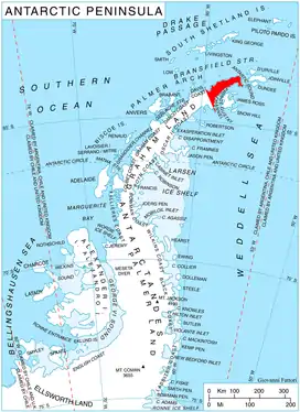
The summit of Zaldapa Ridge is located at 63°36′30″S 57°41′34″W, which is 4.55 km east-northeast of McCalman Peak, 7.06 km south of Abel Nunatak and 4.75 km west by south of Jade Point. German-British mapping in 1996.
Maps
- Trinity Peninsula. Scale 1:250000 topographic map No. 5697. Institut für Angewandte Geodäsie and British Antarctic Survey, 1996.
- Antarctic Digital Database (ADD). Scale 1:250000 topographic map of Antarctica. Scientific Committee on Antarctic Research (SCAR). Since 1993, regularly updated.
Notes
- Reference Elevation Model of Antarctica. Polar Geospatial Center. University of Minnesota, 2019
- Zaldapa Ridge. SCAR Composite Antarctic Gazetteer.
References
- Bulgarian Antarctic Gazetteer. Antarctic Place-names Commission. (details in Bulgarian, basic data in English)
External links
- Zaldapa Ridge. Copernix satellite image
This article includes information from the Antarctic Place-names Commission of Bulgaria which is used with permission.