Brée
Brée (French pronunciation: [bʁe]) is a commune in the Mayenne department in northwestern France.
Brée | |
|---|---|
 The Château de la Grande Courbe, in Brée | |
Location of Brée 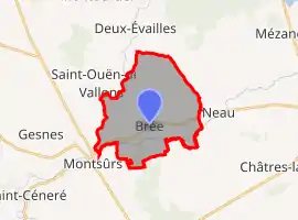 | |
 Brée  Brée | |
| Coordinates: 48°09′04″N 0°31′05″W | |
| Country | France |
| Region | Pays de la Loire |
| Department | Mayenne |
| Arrondissement | Mayenne |
| Canton | Évron |
| Government | |
| • Mayor (2020–2026) | Claude Garnier[1] |
| Area 1 | 16.41 km2 (6.34 sq mi) |
| Population | 554 |
| • Density | 34/km2 (87/sq mi) |
| Time zone | UTC+01:00 (CET) |
| • Summer (DST) | UTC+02:00 (CEST) |
| INSEE/Postal code | 53043 /53150 |
| Elevation | 72–125 m (236–410 ft) (avg. 80 m or 260 ft) |
| 1 French Land Register data, which excludes lakes, ponds, glaciers > 1 km2 (0.386 sq mi or 247 acres) and river estuaries. | |
Population
| Year | Pop. | ±% |
|---|---|---|
| 1962 | 498 | — |
| 1968 | 504 | +1.2% |
| 1975 | 515 | +2.2% |
| 1982 | 540 | +4.9% |
| 1990 | 482 | −10.7% |
| 1999 | 459 | −4.8% |
| 2009 | 510 | +11.1% |
See also
References
- "Répertoire national des élus: les maires". data.gouv.fr, Plateforme ouverte des données publiques françaises (in French). 2 December 2020.
- "Populations légales 2019". The National Institute of Statistics and Economic Studies. 29 December 2021.
| Wikimedia Commons has media related to Brée. |
This article is issued from Wikipedia. The text is licensed under Creative Commons - Attribution - Sharealike. Additional terms may apply for the media files.