Bulukumba Regency
Bulukumba Regency is a regency in the southeast corner of South Sulawesi Province, Indonesia.[2] It covers an area of 1,154.58 km2, and had a population of 394,757 at the 2010 Census[3] and 437,607 at the 2020 Census.[4] The town of Ujung Bulu is its capital.
Bulukumba Regency
Kabupaten Bulukumba | |
|---|---|
 Coat of arms | |
 Location within South Sulawesi | |
| Country | Indonesia |
| Province | South Sulawesi |
| Capital | Ujung Bulu |
| Area | |
| • Total | 1,154.58 km2 (445.79 sq mi) |
| Population (2020 Census)[1] | |
| • Total | 437,607 |
| • Density | 380/km2 (980/sq mi) |
| Time zone | UTC+8 (WITA) |
| Area code(s) | +62 413 |
| Website | www.bulukumbakab.go.id |
Administrative Districts
Bulukumba Regency is divided into ten Districts (Kecamatan), tabulated below with their areas and their populations at the 2010 Census [5] and 2020 Census.[6]

Bulukumba Regency
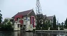
Office of Bulukumba Regent
| Name | Area in km2 | Population Census 2010 | Population Census 2020 |
|---|---|---|---|
| Gantarang | 173.51 | 71,307 | 81,170 |
| Ujung Bulu | 14.44 | 47,886 | 49,060 |
| Ujung Loe | 144.31 | 39,233 | 46,750 |
| Bonto Bahari | 108.60 | 24,116 | 28,260 |
| Bontotiro | 78.34 | 22,768 | 26,920 |
| Herlang | 68.79 | 24,041 | 27,930 |
| Kajang | 129.06 | 46,983 | 48,630 |
| Bulukumpa | 171.33 | 50,607 | 54,090 |
| Rilau Ale | 117.53 | 37,871 | 42,190 |
| Kindang | 148.67 | 29,748 | 32,620 |
| Totals | 1,154.58 | 394,757 | 437,607 |
Pinisi ship
The traditional wooden Pinisi ships are built in Bulukumba, e.g. in Lemo-lemo village.[7]
Climate
Bulukumba has a tropical monsoon climate (Am) with moderate to little rainfall from August to November and heavy rainfall from December to July. The following climate data is for the town of Bulukumba.
| Climate data for Bulukumba | |||||||||||||
|---|---|---|---|---|---|---|---|---|---|---|---|---|---|
| Month | Jan | Feb | Mar | Apr | May | Jun | Jul | Aug | Sep | Oct | Nov | Dec | Year |
| Average high °C (°F) | 30.0 (86.0) |
30.0 (86.0) |
30.4 (86.7) |
31.0 (87.8) |
31.2 (88.2) |
30.8 (87.4) |
30.9 (87.6) |
31.5 (88.7) |
32.0 (89.6) |
32.3 (90.1) |
31.5 (88.7) |
30.3 (86.5) |
31.0 (87.8) |
| Daily mean °C (°F) | 26.4 (79.5) |
26.5 (79.7) |
26.6 (79.9) |
26.8 (80.2) |
26.9 (80.4) |
26.2 (79.2) |
25.8 (78.4) |
25.9 (78.6) |
26.5 (79.7) |
27.1 (80.8) |
27.2 (81.0) |
26.6 (79.9) |
26.5 (79.8) |
| Average low °C (°F) | 22.8 (73.0) |
23.0 (73.4) |
22.8 (73.0) |
22.7 (72.9) |
22.6 (72.7) |
21.7 (71.1) |
20.7 (69.3) |
20.4 (68.7) |
21.0 (69.8) |
21.9 (71.4) |
22.9 (73.2) |
22.9 (73.2) |
22.1 (71.8) |
| Average rainfall mm (inches) | 166 (6.5) |
138 (5.4) |
152 (6.0) |
198 (7.8) |
305 (12.0) |
271 (10.7) |
153 (6.0) |
59 (2.3) |
32 (1.3) |
61 (2.4) |
92 (3.6) |
148 (5.8) |
1,775 (69.8) |
| Source: Climate-Data.org[8] | |||||||||||||
References
- Badan Pusat Statistik, Jakarta, 2021.
- Maplandia.com, retrieved 28 August 2009.
- Biro Pusat Statistik, Jakarta, 2011.
- Badan Pusat Statistik, Jakarta, 2021.
- Biro Pusat Statistik, Jakarta, 2011.
- Badan Pusat Statistik, Jakarta, 2021.
- "Perahu Pinisi di Tanah Beru Bulukumba". June 24, 2013. Archived from the original on July 17, 2013.
- "Climate: Bulukumba". Climate-Data.org. Retrieved 18 November 2020.
Regencies and cities of South Sulawesi | ||
|---|---|---|
Capital: Makassar | ||
| Regencies |  | |
| Cities | ||
This article is issued from Wikipedia. The text is licensed under Creative Commons - Attribution - Sharealike. Additional terms may apply for the media files.