Centrès
Centrès (French pronunciation: [sɑ̃tʁɛs]; Occitan: Centres) is a commune in the Aveyron department in southern France.
Centrès | |
|---|---|
 Coat of arms | |
Location of Centrès 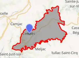 | |
 Centrès  Centrès | |
| Coordinates: 44°09′52″N 2°24′34″E | |
| Country | France |
| Region | Occitania |
| Department | Aveyron |
| Arrondissement | Villefranche-de-Rouergue |
| Canton | Ceor-Ségala |
| Government | |
| • Mayor (2020–2026) | Nadine Vernhes[1] |
| Area 1 | 36.71 km2 (14.17 sq mi) |
| Population | 461 |
| • Density | 13/km2 (33/sq mi) |
| Time zone | UTC+01:00 (CET) |
| • Summer (DST) | UTC+02:00 (CEST) |
| INSEE/Postal code | 12065 /12120 |
| Elevation | 320–605 m (1,050–1,985 ft) (avg. 541 m or 1,775 ft) |
| 1 French Land Register data, which excludes lakes, ponds, glaciers > 1 km2 (0.386 sq mi or 247 acres) and river estuaries. | |
Geography
The river Céor forms most of the commune's southeastern and southern borders, then flows (at Saint-Just-sur-Viaur) into the Viaur, which forms all of its western and northern borders.
Population
| Year | Pop. | ±% |
|---|---|---|
| 1962 | 937 | — |
| 1968 | 1,012 | +8.0% |
| 1975 | 933 | −7.8% |
| 1982 | 826 | −11.5% |
| 1990 | 699 | −15.4% |
| 1999 | 599 | −14.3% |
| 2008 | 549 | −8.3% |
See also
References
- "Répertoire national des élus: les maires". data.gouv.fr, Plateforme ouverte des données publiques françaises (in French). 2 December 2020.
- "Populations légales 2019". The National Institute of Statistics and Economic Studies. 29 December 2021.
| Wikimedia Commons has media related to Centrès. |
This article is issued from Wikipedia. The text is licensed under Creative Commons - Attribution - Sharealike. Additional terms may apply for the media files.