Champcella
Champcella (French pronunciation: [ʃɑ̃sɛla]; Occitan: Champcelat) is a commune in the Hautes-Alpes department in southeastern France.
Champcella | |
|---|---|
 | |
 Coat of arms | |
Location of Champcella 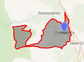 | |
 Champcella  Champcella | |
| Coordinates: 44°43′25″N 6°34′20″E | |
| Country | France |
| Region | Provence-Alpes-Côte d'Azur |
| Department | Hautes-Alpes |
| Arrondissement | Briançon |
| Canton | L'Argentière-la-Bessée |
| Intercommunality | Pays des Écrins |
| Government | |
| • Mayor (2020–2026) | Michel Cheylan[1] |
| Area 1 | 30.25 km2 (11.68 sq mi) |
| Population | 188 |
| • Density | 6.2/km2 (16/sq mi) |
| Time zone | UTC+01:00 (CET) |
| • Summer (DST) | UTC+02:00 (CEST) |
| INSEE/Postal code | 05031 /05310 |
| Elevation | 900–3,156 m (2,953–10,354 ft) (avg. 1,150 m or 3,770 ft) |
| 1 French Land Register data, which excludes lakes, ponds, glaciers > 1 km2 (0.386 sq mi or 247 acres) and river estuaries. | |
Population
| Year | Pop. | ±% |
|---|---|---|
| 1962 | 187 | — |
| 1968 | 197 | +5.3% |
| 1975 | 153 | −22.3% |
| 1982 | 147 | −3.9% |
| 1990 | 156 | +6.1% |
| 1999 | 142 | −9.0% |
| 2008 | 170 | +19.7% |
References
- "Répertoire national des élus: les maires". data.gouv.fr, Plateforme ouverte des données publiques françaises (in French). 2 December 2020. Retrieved 7 December 2020.
- "Populations légales 2019". The National Institute of Statistics and Economic Studies. 29 December 2021.
| Wikimedia Commons has media related to Champcella. |
This article is issued from Wikipedia. The text is licensed under Creative Commons - Attribution - Sharealike. Additional terms may apply for the media files.