Chongnam
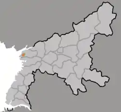
Ch'ŏngnam-gu is a district in South P'yŏngan province, North Korea.
Ch'ŏngnam District
청남 | |
|---|---|
| Korean transcription(s) | |
| • Chosŏn'gŭl | 청남구 |
| • Hancha | 清南區 |
| • McCune–Reischauer | Ch'ŏngnam-gu |
| • Revised Romanization | Cheongnam-gu |
 | |
| Country | North Korea |
| Province | South P'yŏngan |
| Administrative divisions | 9 tong, 2 ri |
| Area | |
| • Total | 359 km2 (139 sq mi) |
| Population (2008) | |
| • Total | 73,290 [1] |
Administrative districts
The district is split into 9 tong (neighborhoods) and 2 ri (villages).
| Chosŏn'gŭl | Hancha | |
|---|---|---|
| Chungsŏng-dong | 충성동 | 忠誠洞 |
| Hyosŏng-dong | 효성동 | 曉星洞 |
| Kangsŏng-dong | 강성동 | 强盛洞 |
| Kom'ŭn'gŭm-dong | 검은금동 | |
| Munhwa-dong | 문화동 | 文化洞 |
| Ragwŏn-dong | 락원동 | 樂園洞 |
| Saegori-dong | 새거리동 | |
| Sangbong-dong | 상봉동 | 相逢洞 |
| San'ŏp-tong | 산업동 | 産業洞 |
| Ryongbung-ri | 룡북리 | 龍北里 |
| Sil-li | 신리 | 新里 |
Transportation
Ch'ŏngnam district is served by the Sŏhae Line of the Korean State Railway.
References
- DPR Korean Central Bureau of Statistics: 2008 Population Census Archived May 14, 2011, at the Wayback Machine (Population 2008, Published in 2009)
External links
- (in English) Map of Pyongan provinces
- (in Korean) Detailed map

This article is issued from Wikipedia. The text is licensed under Creative Commons - Attribution - Sharealike. Additional terms may apply for the media files.