Estoher
Estoher (French pronunciation: [ɛstɔe] (![]() listen); Catalan: Estoer) is a commune in the Pyrénées-Orientales department in southern France.
listen); Catalan: Estoer) is a commune in the Pyrénées-Orientales department in southern France.
Estoher
Estoer | |
|---|---|
.jpg.webp) A postcard view of Estoher, in the early 20th century | |
 Coat of arms | |
Location of Estoher  | |
 Estoher  Estoher | |
| Coordinates: 42°36′06″N 2°29′13″E | |
| Country | France |
| Region | Occitania |
| Department | Pyrénées-Orientales |
| Arrondissement | Prades |
| Canton | Le Canigou |
| Intercommunality | Conflent Canigó |
| Government | |
| • Mayor (2020–2026) | Marie-Edith Peral[1] |
| Area 1 | 26.08 km2 (10.07 sq mi) |
| Population | 138 |
| • Density | 5.3/km2 (14/sq mi) |
| Time zone | UTC+01:00 (CET) |
| • Summer (DST) | UTC+02:00 (CEST) |
| INSEE/Postal code | 66073 /66320 |
| Elevation | 336–2,481 m (1,102–8,140 ft) (avg. 360 m or 1,180 ft) |
| 1 French Land Register data, which excludes lakes, ponds, glaciers > 1 km2 (0.386 sq mi or 247 acres) and river estuaries. | |
Geography
Localisation
Estoher is located in the canton of Le Canigou and in the arrondissement of Prades.
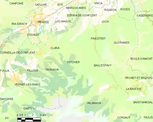
Map of Estoher and its surrounding communes
Places adjacent to Estoher | |
|---|---|
Population
| Year | Pop. | ±% p.a. |
|---|---|---|
| 1968 | 165 | — |
| 1975 | 127 | −3.67% |
| 1982 | 115 | −1.41% |
| 1990 | 124 | +0.95% |
| 1999 | 134 | +0.87% |
| 2007 | 154 | +1.75% |
| 2012 | 153 | −0.13% |
| 2017 | 145 | −1.07% |
| Source: INSEE[3] | ||
References
- "Répertoire national des élus: les maires". data.gouv.fr, Plateforme ouverte des données publiques françaises (in French). 2 December 2020.
- "Populations légales 2019". The National Institute of Statistics and Economic Studies. 29 December 2021.
- Population en historique depuis 1968, INSEE
| Wikimedia Commons has media related to Estoher. |
This article is issued from Wikipedia. The text is licensed under Creative Commons - Attribution - Sharealike. Additional terms may apply for the media files.