Gurunhuel
Gurunhuel (French pronunciation: [ɡyʁynɥɛl] (![]() listen); Breton: Gurunuhel) is a commune in the Côtes-d'Armor department of Brittany in northwestern France.
listen); Breton: Gurunuhel) is a commune in the Côtes-d'Armor department of Brittany in northwestern France.
Gurunhuel
Gurunuhel | |
|---|---|
_%C3%89glise_02.JPG.webp) The church of Notre-Dame, in Gurunhuel | |
Location of Gurunhuel 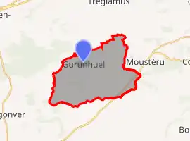 | |
 Gurunhuel  Gurunhuel | |
| Coordinates: 48°31′01″N 3°17′57″W | |
| Country | France |
| Region | Brittany |
| Department | Côtes-d'Armor |
| Arrondissement | Guingamp |
| Canton | Callac |
| Government | |
| • Mayor (2020–2026) | Paul Rolland[1] |
| Area 1 | 19.58 km2 (7.56 sq mi) |
| Population | 407 |
| • Density | 21/km2 (54/sq mi) |
| Time zone | UTC+01:00 (CET) |
| • Summer (DST) | UTC+02:00 (CEST) |
| INSEE/Postal code | 22072 /22390 |
| Elevation | 159–302 m (522–991 ft) |
| 1 French Land Register data, which excludes lakes, ponds, glaciers > 1 km2 (0.386 sq mi or 247 acres) and river estuaries. | |
Population
|
|
The inhabitants of Gurunhuel are known in French as gurunhuelois.
References
- "Répertoire national des élus: les maires". data.gouv.fr, Plateforme ouverte des données publiques françaises (in French). 2 December 2020.
- "Populations légales 2019". The National Institute of Statistics and Economic Studies. 29 December 2021.
External links
| Wikimedia Commons has media related to Gurunhuel. |
- Base Mérimée: Search for heritage in the commune, Ministère français de la Culture. (in French)
This article is issued from Wikipedia. The text is licensed under Creative Commons - Attribution - Sharealike. Additional terms may apply for the media files.