Lankeys Creek, New South Wales
Lankeys Creek is a rural community in the east part of the Riverina. It is situated by road, about 18 kilometres north west of Jingellic and 36 kilometres south east of Holbrook.
| Lankeys Creek New South Wales | |
|---|---|
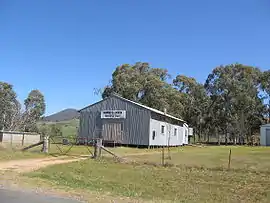 Memorial Hall | |
Lankeys Creek | |
| Coordinates | 35°49′S 147°40′E |
| Postcode(s) | 2644 |
| Elevation | 355 m (1,165 ft) |
| Location | |
| LGA(s) | Greater Hume Shire Council |
| County | Goulburn |
| State electorate(s) | Albury |
Lankeys Creek Post Office was open briefly in 1890, reopened in 1906 and closed in 1961.[1]
Notes and references
- Premier Postal History, Post Office List, retrieved 11 June 2009
| Wikimedia Commons has media related to Lankeys Creek, New South Wales. |
This article is issued from Wikipedia. The text is licensed under Creative Commons - Attribution - Sharealike. Additional terms may apply for the media files.