Montbray
Montbray (French pronunciation: [mɔ̃bʁɛ]) is a commune in the Manche department in Normandy in north-western France.
Montbray | |
|---|---|
 The chapel of Saint-Pierre | |
Location of Montbray 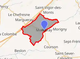 | |
 Montbray  Montbray | |
| Coordinates: 48°52′52″N 1°05′40″W | |
| Country | France |
| Region | Normandy |
| Department | Manche |
| Arrondissement | Saint-Lô |
| Canton | Villedieu-les-Poêles-Rouffigny |
| Intercommunality | Villedieu Intercom |
| Government | |
| • Mayor (2020–2026) | Jean-Marie Ligneul[1] |
| Area 1 | 14.04 km2 (5.42 sq mi) |
| Population | 299 |
| • Density | 21/km2 (55/sq mi) |
| Demonym(s) | Montbrayons |
| Time zone | UTC+01:00 (CET) |
| • Summer (DST) | UTC+02:00 (CEST) |
| INSEE/Postal code | 50338 /50410 |
| Elevation | 79–266 m (259–873 ft) (avg. 90 m or 300 ft) |
| 1 French Land Register data, which excludes lakes, ponds, glaciers > 1 km2 (0.386 sq mi or 247 acres) and river estuaries. | |
The village has an ancient château which belongs to the commune and houses the town hall and the village nursery school. The village also has a church, a bar, a bakery, a garage and a children's play area with picnic tables and a pond.
See also
References
- "Répertoire national des élus: les maires". data.gouv.fr, Plateforme ouverte des données publiques françaises (in French). 2 December 2020.
- "Populations légales 2019". The National Institute of Statistics and Economic Studies. 29 December 2021.
| Wikimedia Commons has media related to Montbray. |
This article is issued from Wikipedia. The text is licensed under Creative Commons - Attribution - Sharealike. Additional terms may apply for the media files.