Montgreleix
Montgreleix is a commune in the Cantal department in south-central France.
Montgreleix | |
|---|---|
 The church of Saint-Laurent, in Montgreleix | |
Location of Montgreleix 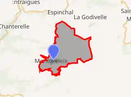 | |
 Montgreleix  Montgreleix | |
| Coordinates: 45°20′44″N 2°52′15″E | |
| Country | France |
| Region | Auvergne-Rhône-Alpes |
| Department | Cantal |
| Arrondissement | Saint-Flour |
| Canton | Riom-ès-Montagnes |
| Government | |
| • Mayor (2020–2026) | Jean Mage[1] |
| Area 1 | 17.63 km2 (6.81 sq mi) |
| Population | 45 |
| • Density | 2.6/km2 (6.6/sq mi) |
| Time zone | UTC+01:00 (CET) |
| • Summer (DST) | UTC+02:00 (CEST) |
| INSEE/Postal code | 15132 /15190 |
| Elevation | 1,036–1,426 m (3,399–4,678 ft) (avg. 1,238 m or 4,062 ft) |
| 1 French Land Register data, which excludes lakes, ponds, glaciers > 1 km2 (0.386 sq mi or 247 acres) and river estuaries. | |
Population
| Year | Pop. | ±% |
|---|---|---|
| 1962 | 128 | — |
| 1968 | 116 | −9.4% |
| 1975 | 113 | −2.6% |
| 1982 | 91 | −19.5% |
| 1990 | 57 | −37.4% |
| 1999 | 67 | +17.5% |
| 2008 | 47 | −29.9% |
See also
References
- "Répertoire national des élus: les maires". data.gouv.fr, Plateforme ouverte des données publiques françaises (in French). 2 December 2020.
- "Populations légales 2019". The National Institute of Statistics and Economic Studies. 29 December 2021.
| Wikimedia Commons has media related to Montgreleix. |
This article is issued from Wikipedia. The text is licensed under Creative Commons - Attribution - Sharealike. Additional terms may apply for the media files.