Powderhorn, Minneapolis
Powderhorn is a community in Minneapolis, which consists of eight different neighborhoods.
Powderhorn | |
|---|---|
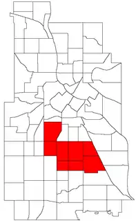 Location of Powderhorn within the U.S. city of Minneapolis | |
| Country | United States |
| State | Minnesota |
| County | Hennepin |
| City | Minneapolis |
| Neighborhoods | |
| Area | |
| • Total | 4.559 sq mi (11.81 km2) |
| Population (2010)[2] | |
| • Total | 54,743 |
| • Density | 12,000/sq mi (4,600/km2) |
| Time zone | UTC-6 (CST) |
| • Summer (DST) | UTC-5 (CDT) |
| ZIP code | 55404, 55405, 55406, 55407, 55408, 55409 |
| Area code(s) | 612 |
| Historical population | |||
|---|---|---|---|
| Census | Pop. | %± | |
| 1980 | 51,519 | — | |
| 1990 | 51,954 | 0.8% | |
| 2000 | 57,299 | 10.3% | |
| 2010 | 54,743 | −4.5% | |
Neighborhoods in the Powderhorn community
While most of Powderhorn is east of Interstate 35W and south of Lake Street, both the Lyndale and Whittier neighborhoods are west of I-35W, while Whittier is also north of Lake Street.
See also
References
- "Powderhorn neighborhood in Minneapolis, Minnesota (MN), 55404, 55406, 55407, 55408, 55409 detailed profile". City-Data. 2011. Retrieved 2013-11-12.
- "Minneapolis Community Profile: Powderhorn" (PDF). Minnesota Compass. October 2011. Retrieved 2013-11-12.
- Powderhorn, Minneapolis, MN. Google Earth. Retrieved 2011-03-09.
External links
This article is issued from Wikipedia. The text is licensed under Creative Commons - Attribution - Sharealike. Additional terms may apply for the media files.