Saint-Chabrais
Saint-Chabrais (French pronunciation: [sɛ̃ ʃabʁɛ]; Occitan: Sent Chabrés) is a commune in the Creuse department in central France.
Saint-Chabrais | |
|---|---|
Location of Saint-Chabrais 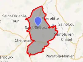 | |
 Saint-Chabrais  Saint-Chabrais | |
| Coordinates: 46°07′59″N 2°12′19″E | |
| Country | France |
| Region | Nouvelle-Aquitaine |
| Department | Creuse |
| Arrondissement | Aubusson |
| Canton | Gouzon |
| Intercommunality | CC Marche et Combraille en Aquitaine |
| Government | |
| • Mayor (2020–2026) | Patrice Morançais[1] |
| Area 1 | 24.94 km2 (9.63 sq mi) |
| Population | 284 |
| • Density | 11/km2 (29/sq mi) |
| Time zone | UTC+01:00 (CET) |
| • Summer (DST) | UTC+02:00 (CEST) |
| INSEE/Postal code | 23185 /23130 |
| Elevation | 389–542 m (1,276–1,778 ft) (avg. 456 m or 1,496 ft) |
| 1 French Land Register data, which excludes lakes, ponds, glaciers > 1 km2 (0.386 sq mi or 247 acres) and river estuaries. | |
Population
| Year | Pop. | ±% |
|---|---|---|
| 1962 | 564 | — |
| 1968 | 537 | −4.8% |
| 1975 | 469 | −12.7% |
| 1982 | 399 | −14.9% |
| 1990 | 379 | −5.0% |
| 1999 | 335 | −11.6% |
| 2008 | 325 | −3.0% |
See also
References
- "Répertoire national des élus: les maires". data.gouv.fr, Plateforme ouverte des données publiques françaises (in French). 2 December 2020.
- "Populations légales 2019". The National Institute of Statistics and Economic Studies. 29 December 2021.
| Wikimedia Commons has media related to Saint-Chabrais. |
This article is issued from Wikipedia. The text is licensed under Creative Commons - Attribution - Sharealike. Additional terms may apply for the media files.