Saint-Froult
Saint-Froult (French pronunciation: [sɛ̃ fʁu]) is a commune in the Charente-Maritime department in southwestern France.
Saint-Froult | |
|---|---|
 A general view of Saint-Froult | |
Location of Saint-Froult 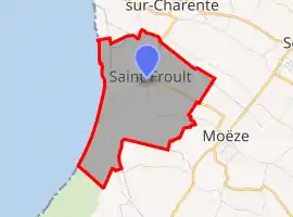 | |
 Saint-Froult  Saint-Froult | |
| Coordinates: 45°55′07″N 1°03′31″W | |
| Country | France |
| Region | Nouvelle-Aquitaine |
| Department | Charente-Maritime |
| Arrondissement | Rochefort |
| Canton | Marennes |
| Government | |
| • Mayor (2020–2026) | Simon Villard |
| Area 1 | 6.39 km2 (2.47 sq mi) |
| Population | 357 |
| • Density | 56/km2 (140/sq mi) |
| Time zone | UTC+01:00 (CET) |
| • Summer (DST) | UTC+02:00 (CEST) |
| INSEE/Postal code | 17329 /17780 |
| Elevation | 0–10 m (0–33 ft) (avg. 5 m or 16 ft) |
| 1 French Land Register data, which excludes lakes, ponds, glaciers > 1 km2 (0.386 sq mi or 247 acres) and river estuaries. | |
Population
| Year | Pop. | ±% |
|---|---|---|
| 1962 | 148 | — |
| 1968 | 180 | +21.6% |
| 1975 | 182 | +1.1% |
| 1982 | 227 | +24.7% |
| 1990 | 245 | +7.9% |
| 1999 | 234 | −4.5% |
| 2008 | 300 | +28.2% |
References
- "Populations légales 2019". The National Institute of Statistics and Economic Studies. 29 December 2021.
| Wikimedia Commons has media related to Saint-Froult. |
This article is issued from Wikipedia. The text is licensed under Creative Commons - Attribution - Sharealike. Additional terms may apply for the media files.