Solarolo
Solarolo (Romagnol: Slarôl) is a comune (municipality) in the Province of Ravenna in the Italian region of Emilia-Romagna, located about 40 kilometres (25 mi) southeast of Bologna and about 30 kilometres (19 mi) west of Ravenna.
Solarolo
| |
|---|---|
| Comune di Solarolo | |
Location of Solarolo 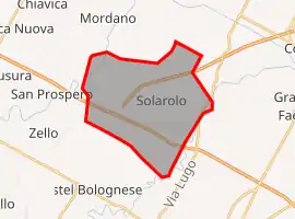 | |
 Solarolo Location of Solarolo in Italy  Solarolo Solarolo (Emilia-Romagna) | |
| Coordinates: 44°22′N 11°51′E | |
| Country | Italy |
| Region | Emilia-Romagna |
| Province | Ravenna (RA) |
| Government | |
| • Mayor | Fabio Anconelli |
| Area | |
| • Total | 26.3 km2 (10.2 sq mi) |
| Elevation | 25 m (82 ft) |
| Population (31 December 2014)[2] | |
| • Total | 4,472 |
| • Density | 170/km2 (440/sq mi) |
| Demonym(s) | Solarolesi |
| Time zone | UTC+1 (CET) |
| • Summer (DST) | UTC+2 (CEST) |
| Postal code | 48027 |
| Dialing code | 0546 |
| Website | Official website |
Solarolo borders the following municipalities: Bagnara di Romagna, Castel Bolognese, Cotignola, Faenza, Imola.
It is known for being singer Laura Pausini's home town.
History
The area has been inhabited since the Bronze Age. Ruins of a village were found: the settlement was active between 1600 and 1200 B.C. and it was organized in distinct clusters separated by trenches; evidence of bovine rearing and cultivation of cereals was found.[3][4] Starting from 187 B.C., an intense activity of centuriation was performed by the Romans and this is still visible nowadays in the lattice of the streets in the countryside; villae were also built in this lattice.[5]
The toponym Solarolus appears for the first time in 993 as the name of an acreage and only in 1138 as Castrum Solarolii connected with a fortification. During the following centuries, the area of Solarolo changed several dominations, mainly by the families Manfredi, Borgia, Gonzaga, Este.[5]
During the 17th century, Solarolo became part of the Papal States and, during the 19th century, of the newborn Kingdom of Italy.
Twin towns – sister cities
Solarolo is twinned with:
 Rhêmes-Notre-Dame, Italy, since 1999
 Kirchheim am Ries, Germany, since 1999
References
- "Superficie di Comuni Province e Regioni italiane al 9 ottobre 2011". Italian National Institute of Statistics. Retrieved 16 March 2019.
- All demographics and other statistics: Italian statistical institute Istat.
- "Gli scavi nell'abitato di via Ordiere a Solarolo (RA)". Retrieved 27 October 2015.
- "Solarolo nel II millennio a.C." Retrieved 27 October 2015.
- "History of Solarolo on the municipal website". Retrieved 27 October 2015.
External links
 | ||