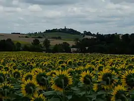
Teyssode
Teyssode (French pronunciation: [tɛsɔd]; Languedocien: Teissòde) is a commune in the Tarn department in southern France.
Teyssode | |
|---|---|
 Teyssode and its surroundings | |
.svg.png.webp) Coat of arms | |
Location of Teyssode 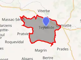 | |
 Teyssode  Teyssode | |
| Coordinates: 43°39′02″N 1°56′08″E | |
| Country | France |
| Region | Occitania |
| Department | Tarn |
| Arrondissement | Castres |
| Canton | Plaine de l'Agoût |
| Intercommunality | Lautrécois-Pays d'Agout |
| Government | |
| • Mayor (2020–2026) | Francis Moulet[1] |
| Area 1 | 22.88 km2 (8.83 sq mi) |
| Population | 382 |
| • Density | 17/km2 (43/sq mi) |
| Time zone | UTC+01:00 (CET) |
| • Summer (DST) | UTC+02:00 (CEST) |
| INSEE/Postal code | 81299 /81220 |
| Elevation | 127–327 m (417–1,073 ft) (avg. 288 m or 945 ft) |
| 1 French Land Register data, which excludes lakes, ponds, glaciers > 1 km2 (0.386 sq mi or 247 acres) and river estuaries. | |
Geography
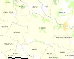
Neighbouring communes
Places adjacent to Teyssode | |
|---|---|
Toponymy
The name of Teyssode is of gallo-romance origin, from the word taxo meaning badger.[3]
History
Teyssode is located on a former Roman oppidum.
In 1824, Teyssode absorbed the neighbouring commune of Saint-Germier.
See also
References
- "Répertoire national des élus: les maires". data.gouv.fr, Plateforme ouverte des données publiques françaises (in French). 9 August 2021.
- "Populations légales 2019". The National Institute of Statistics and Economic Studies. 29 December 2021.
- Teyssode Archived 2012-01-27 at the Wayback Machine on the website of the Intercommunality of the Pays d'Agout
This article is issued from Wikipedia. The text is licensed under Creative Commons - Attribution - Sharealike. Additional terms may apply for the media files.