Béthonvilliers
Béthonvilliers is a commune in the Eure-et-Loir department in northern France.
Béthonvilliers | |
|---|---|
 The church in Béthonvilliers | |
Location of Béthonvilliers 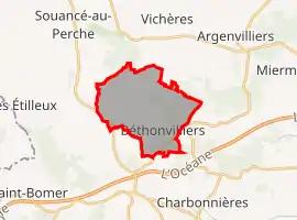 | |
 Béthonvilliers  Béthonvilliers | |
| Coordinates: 48°13′19″N 0°54′37″E | |
| Country | France |
| Region | Centre-Val de Loire |
| Department | Eure-et-Loir |
| Arrondissement | Nogent-le-Rotrou |
| Canton | Brou |
| Intercommunality | Perche |
| Government | |
| • Mayor (2020–2026) | Claude Épinette[1] |
| Area 1 | 12.33 km2 (4.76 sq mi) |
| Population | 112 |
| • Density | 9.1/km2 (24/sq mi) |
| Time zone | UTC+01:00 (CET) |
| • Summer (DST) | UTC+02:00 (CEST) |
| INSEE/Postal code | 28038 /28330 |
| Elevation | 156–261 m (512–856 ft) (avg. 250 m or 820 ft) |
| 1 French Land Register data, which excludes lakes, ponds, glaciers > 1 km2 (0.386 sq mi or 247 acres) and river estuaries. | |
Population
| Year | Pop. | ±% |
|---|---|---|
| 1962 | 131 | — |
| 1968 | 180 | +37.4% |
| 1975 | 163 | −9.4% |
| 1982 | 147 | −9.8% |
| 1990 | 145 | −1.4% |
| 1999 | 133 | −8.3% |
| 2008 | 138 | +3.8% |
References
- "Répertoire national des élus: les maires". data.gouv.fr, Plateforme ouverte des données publiques françaises (in French). 2 December 2020.
- "Populations légales 2019". The National Institute of Statistics and Economic Studies. 29 December 2021.
| Wikimedia Commons has media related to Béthonvilliers. |
This article is issued from Wikipedia. The text is licensed under Creative Commons - Attribution - Sharealike. Additional terms may apply for the media files.