Ver-lès-Chartres
Ver-lès-Chartres (French pronunciation: [vɛʁ lɛ ʃaʁtʁ], literally Ver near Chartres) is a commune in the Eure-et-Loir department in northern France.
Ver-lès-Chartres | |
|---|---|
.JPG.webp) The wash house in Ver-lès-Chartres | |
Location of Ver-lès-Chartres 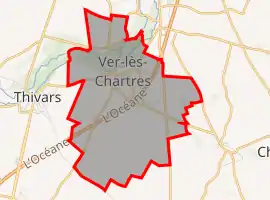 | |
 Ver-lès-Chartres  Ver-lès-Chartres | |
| Coordinates: 48°23′10″N 1°28′45″E | |
| Country | France |
| Region | Centre-Val de Loire |
| Department | Eure-et-Loir |
| Arrondissement | Chartres |
| Canton | Chartres-2 |
| Intercommunality | CA Chartres Métropole |
| Government | |
| • Mayor (2020–2026) | Max Van Der Stichele |
| Area 1 | 9.46 km2 (3.65 sq mi) |
| Population | 770 |
| • Density | 81/km2 (210/sq mi) |
| Time zone | UTC+01:00 (CET) |
| • Summer (DST) | UTC+02:00 (CEST) |
| INSEE/Postal code | 28403 /28630 |
| Elevation | 128–161 m (420–528 ft) (avg. 135 m or 443 ft) |
| 1 French Land Register data, which excludes lakes, ponds, glaciers > 1 km2 (0.386 sq mi or 247 acres) and river estuaries. | |
Population
| Year | Pop. | ±% |
|---|---|---|
| 1962 | 310 | — |
| 1968 | 330 | +6.5% |
| 1975 | 560 | +69.7% |
| 1982 | 708 | +26.4% |
| 1990 | 748 | +5.6% |
| 1999 | 724 | −3.2% |
| 2008 | 783 | +8.1% |
References
- "Populations légales 2019". The National Institute of Statistics and Economic Studies. 29 December 2021.
| Wikimedia Commons has media related to Ver-lès-Chartres. |
This article is issued from Wikipedia. The text is licensed under Creative Commons - Attribution - Sharealike. Additional terms may apply for the media files.