Broût-Vernet
Broût-Vernet (French pronunciation: [bʁu vɛʁnɛ]; Occitan: Brot e Le Vernet) is a commune in the Allier department in central France. It is around 15 km north-west of Vichy and 40 km north of Clermont-Ferrand.
Broût-Vernet | |
|---|---|
.jpg.webp) Aubeterre priory | |
.svg.png.webp) Coat of arms | |
Location of Broût-Vernet 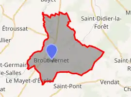 | |
 Broût-Vernet  Broût-Vernet | |
| Coordinates: 46°11′20″N 3°16′26″E | |
| Country | France |
| Region | Auvergne-Rhône-Alpes |
| Department | Allier |
| Arrondissement | Vichy |
| Canton | Bellerive-sur-Allier |
| Government | |
| • Mayor (2020–2026) | Bernard Devoucoux[1] |
| Area 1 | 31.71 km2 (12.24 sq mi) |
| Population | 1,189 |
| • Density | 37/km2 (97/sq mi) |
| Time zone | UTC+01:00 (CET) |
| • Summer (DST) | UTC+02:00 (CEST) |
| INSEE/Postal code | 03043 /03110 |
| Elevation | 253–331 m (830–1,086 ft) (avg. 310 m or 1,020 ft) |
| 1 French Land Register data, which excludes lakes, ponds, glaciers > 1 km2 (0.386 sq mi or 247 acres) and river estuaries. | |
Population
| Year | Pop. | ±% p.a. |
|---|---|---|
| 1968 | 1,061 | — |
| 1975 | 994 | −0.93% |
| 1982 | 1,048 | +0.76% |
| 1990 | 1,035 | −0.16% |
| 1999 | 1,068 | +0.35% |
| 2007 | 1,159 | +1.03% |
| 2012 | 1,187 | +0.48% |
| 2017 | 1,169 | −0.31% |
| Source: INSEE[3] | ||
See also
References
- "Liste nominative des communes de l'Allier" [Nominative list of communes of Allier] (PDF) (in French). Association of Mayors and Presidents of Communities of Allier. 8 July 2020. Retrieved 6 December 2020.
- "Populations légales 2019". The National Institute of Statistics and Economic Studies. 29 December 2021.
- Population en historique depuis 1968, INSEE
| Wikimedia Commons has media related to Broût-Vernet. |
This article is issued from Wikipedia. The text is licensed under Creative Commons - Attribution - Sharealike. Additional terms may apply for the media files.