Lételon
Lételon (French pronunciation: [letlɔ̃]) is a commune in the Allier department in central France.
Lételon | |
|---|---|
Location of Lételon 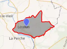 | |
 Lételon  Lételon | |
| Coordinates: 46°39′24″N 2°35′10″E | |
| Country | France |
| Region | Auvergne-Rhône-Alpes |
| Department | Allier |
| Arrondissement | Montluçon |
| Canton | Bourbon-l'Archambault |
| Intercommunality | Pays de Tronçais |
| Government | |
| • Mayor (2020–2026) | David Loubry[1] |
| Area 1 | 6.37 km2 (2.46 sq mi) |
| Population | 92 |
| • Density | 14/km2 (37/sq mi) |
| Time zone | UTC+01:00 (CET) |
| • Summer (DST) | UTC+02:00 (CEST) |
| INSEE/Postal code | 03143 /03360 |
| Elevation | 158–237 m (518–778 ft) (avg. 328 m or 1,076 ft) |
| 1 French Land Register data, which excludes lakes, ponds, glaciers > 1 km2 (0.386 sq mi or 247 acres) and river estuaries. | |
Population
| Year | Pop. | ±% |
|---|---|---|
| 1962 | 164 | — |
| 1968 | 166 | +1.2% |
| 1975 | 165 | −0.6% |
| 1982 | 155 | −6.1% |
| 1990 | 143 | −7.7% |
| 1999 | 144 | +0.7% |
| 2008 | 128 | −11.1% |
| 2012 | 116 | −9.4% |
| Source: INSEE (1968–2012) | ||
See also
References
- "Liste nominative des communes de l'Allier" [Nominative list of communes of Allier] (PDF). maires-allier.fr (in French). Association of Mayors and Presidents of Communities of Allier. 8 July 2020. p. 3. Retrieved 31 December 2020.
- "Populations légales 2019". The National Institute of Statistics and Economic Studies. 29 December 2021.
| Wikimedia Commons has media related to Lételon. |
This article is issued from Wikipedia. The text is licensed under Creative Commons - Attribution - Sharealike. Additional terms may apply for the media files.