Chenereilles, Haute-Loire
Chenereilles (French pronunciation: [ʃənəʁɛj]; Occitan: Chanarelhas) is a commune in the Haute-Loire department in south-central France.
Chenereilles | |
|---|---|
Commune | |
Location of Chenereilles 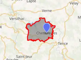 | |
 Chenereilles  Chenereilles | |
| Coordinates: 45°08′03″N 4°15′10″E | |
| Country | France |
| Region | Auvergne-Rhône-Alpes |
| Department | Haute-Loire |
| Arrondissement | Yssingeaux |
| Canton | Boutières |
| Government | |
| • Mayor (2020–2026) | Philippe Digonnet |
| Area 1 | 14.42 km2 (5.57 sq mi) |
| Population | 319 |
| • Density | 22/km2 (57/sq mi) |
| Time zone | UTC+01:00 (CET) |
| • Summer (DST) | UTC+02:00 (CEST) |
| INSEE/Postal code | 43069 /43190 |
| Elevation | 806–956 m (2,644–3,136 ft) (avg. 850 m or 2,790 ft) |
| 1 French Land Register data, which excludes lakes, ponds, glaciers > 1 km2 (0.386 sq mi or 247 acres) and river estuaries. | |
Geography
The river Lignon du Velay flows through the commune.
Population
| Year | Pop. | ±% |
|---|---|---|
| 1876 | 630 | — |
| 1881 | 635 | +0.8% |
| 1891 | 765 | +20.5% |
| 1901 | 784 | +2.5% |
| 1911 | 816 | +4.1% |
| 1921 | 675 | −17.3% |
| 1931 | 642 | −4.9% |
| 1946 | 481 | −25.1% |
| 1954 | 396 | −17.7% |
| 1962 | 364 | −8.1% |
| 1968 | 298 | −18.1% |
| 1975 | 231 | −22.5% |
| 1982 | 220 | −4.8% |
| 1990 | 217 | −1.4% |
| 1999 | 242 | +11.5% |
| 2011 | 312 | +28.9% |
| 2017 | 325 | +4.2% |
References
- "Populations légales 2019". The National Institute of Statistics and Economic Studies. 29 December 2021.
See also
| Wikimedia Commons has media related to Chenereilles (Haute-Loire). |
This article is issued from Wikipedia. The text is licensed under Creative Commons - Attribution - Sharealike. Additional terms may apply for the media files.