Bray, Eure
Bray (French pronunciation: [bʁe]) is a commune in the Eure department in Normandy in northern France.
Bray | |
|---|---|
_%C3%A9glise_Notre-Dame.JPG.webp) The church in Bray | |
Location of Bray 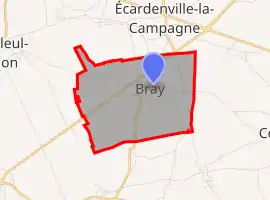 | |
 Bray  Bray | |
| Coordinates: 49°06′28″N 0°50′36″E | |
| Country | France |
| Region | Normandy |
| Department | Eure |
| Arrondissement | Bernay |
| Canton | Brionne |
| Government | |
| • Mayor (2020–2026) | Danielle Camus[1] |
| Area 1 | 5.85 km2 (2.26 sq mi) |
| Population | 398 |
| • Density | 68/km2 (180/sq mi) |
| Time zone | UTC+01:00 (CET) |
| • Summer (DST) | UTC+02:00 (CEST) |
| INSEE/Postal code | 27109 /27170 |
| Elevation | 143–161 m (469–528 ft) (avg. 145 m or 476 ft) |
| 1 French Land Register data, which excludes lakes, ponds, glaciers > 1 km2 (0.386 sq mi or 247 acres) and river estuaries. | |
Population
| Year | Pop. | ±% |
|---|---|---|
| 1962 | 202 | — |
| 1968 | 208 | +3.0% |
| 1975 | 191 | −8.2% |
| 1982 | 189 | −1.0% |
| 1990 | 244 | +29.1% |
| 1999 | 246 | +0.8% |
| 2008 | 288 | +17.1% |
See also
References
- "Répertoire national des élus: les maires". data.gouv.fr, Plateforme ouverte des données publiques françaises (in French). 9 August 2021.
- "Populations légales 2019". The National Institute of Statistics and Economic Studies. 29 December 2021.
| Wikimedia Commons has media related to Bray (Eure). |
This article is issued from Wikipedia. The text is licensed under Creative Commons - Attribution - Sharealike. Additional terms may apply for the media files.