Saint-Étienne-du-Vauvray
Saint-Étienne-du-Vauvray (French pronunciation: [sɛ̃.t‿etjɛn dy vovʁɛ]) is a commune in the Eure department in the Normandy region in northern France.
Saint-Étienne-du-Vauvray | |
|---|---|
 Menhir | |
.svg.png.webp) Coat of arms | |
Location of Saint-Étienne-du-Vauvray 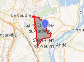 | |
 Saint-Étienne-du-Vauvray  Saint-Étienne-du-Vauvray | |
| Coordinates: 49°14′37″N 1°13′16″E | |
| Country | France |
| Region | Normandy |
| Department | Eure |
| Arrondissement | Les Andelys |
| Canton | Louviers |
| Intercommunality | CA Seine-Eure |
| Government | |
| • Mayor (2020–2026) | Eric Lardeur[1] |
| Area 1 | 8.84 km2 (3.41 sq mi) |
| Population | 876 |
| • Density | 99/km2 (260/sq mi) |
| Time zone | UTC+01:00 (CET) |
| • Summer (DST) | UTC+02:00 (CEST) |
| INSEE/Postal code | 27537 /27430 |
| Elevation | 7–73 m (23–240 ft) (avg. 13 m or 43 ft) |
| 1 French Land Register data, which excludes lakes, ponds, glaciers > 1 km2 (0.386 sq mi or 247 acres) and river estuaries. | |
Population
|
|
See also
References
- "Répertoire national des élus: les maires". data.gouv.fr, Plateforme ouverte des données publiques françaises (in French). 9 August 2021.
- "Populations légales 2019". The National Institute of Statistics and Economic Studies. 29 December 2021.
| Wikimedia Commons has media related to Saint-Étienne-du-Vauvray. |
This article is issued from Wikipedia. The text is licensed under Creative Commons - Attribution - Sharealike. Additional terms may apply for the media files.