Caharet
Caharet is a commune in the Hautes-Pyrénées department in south-western France.
Caharet | |
|---|---|
_1.jpg.webp) View of Caharet | |
Location of Caharet 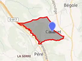 | |
 Caharet  Caharet | |
| Coordinates: 43°08′44″N 0°19′06″E | |
| Country | France |
| Region | Occitania |
| Department | Hautes-Pyrénées |
| Arrondissement | Tarbes |
| Canton | La Vallée de l'Arros et des Baïses |
| Intercommunality | Coteaux du Val d'Arros |
| Area 1 | 1.23 km2 (0.47 sq mi) |
| Population | 38 |
| • Density | 31/km2 (80/sq mi) |
| Time zone | UTC+01:00 (CET) |
| • Summer (DST) | UTC+02:00 (CEST) |
| INSEE/Postal code | 65118 /65190 |
| Elevation | 408–569 m (1,339–1,867 ft) (avg. 600 m or 2,000 ft) |
| 1 French Land Register data, which excludes lakes, ponds, glaciers > 1 km2 (0.386 sq mi or 247 acres) and river estuaries. | |
References
- "Populations légales 2019". The National Institute of Statistics and Economic Studies. 29 December 2021.
| Wikimedia Commons has media related to Caharet. |
This article is issued from Wikipedia. The text is licensed under Creative Commons - Attribution - Sharealike. Additional terms may apply for the media files.