Guillac, Gironde
Guillac (French pronunciation: [ɡijak]; Occitan: Guilhac) is a commune in the Gironde department in southwestern France.
Guillac | |
|---|---|
 The town hall in Guillac | |
.svg.png.webp) Coat of arms | |
Location of Guillac 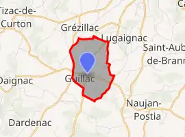 | |
 Guillac  Guillac | |
| Coordinates: 44°48′07″N 0°12′43″W | |
| Country | France |
| Region | Nouvelle-Aquitaine |
| Department | Gironde |
| Arrondissement | Libourne |
| Canton | Les Coteaux de Dordogne |
| Government | |
| • Mayor (2020–2026) | Jacky Fromentier[1] |
| Area 1 | 3.06 km2 (1.18 sq mi) |
| Population | 160 |
| • Density | 52/km2 (140/sq mi) |
| Time zone | UTC+01:00 (CET) |
| • Summer (DST) | UTC+02:00 (CEST) |
| INSEE/Postal code | 33196 /33420 |
| Elevation | 25–87 m (82–285 ft) (avg. 75 m or 246 ft) |
| 1 French Land Register data, which excludes lakes, ponds, glaciers > 1 km2 (0.386 sq mi or 247 acres) and river estuaries. | |
It is 32 km east of Bordeaux, 13 km north east of Creon and 5 km south west of Branne and the river Dordogne.
St Seurin's church, named after the early Bishop of Bordeaux, was originally part of the Grande-Sauve Abbey.
The part-14th-century chateau Rebullide [3] is one of a number of local vineyards.[4]
Population
| Year | Pop. | ±% |
|---|---|---|
| 1962 | 195 | — |
| 1968 | 207 | +6.2% |
| 1975 | 167 | −19.3% |
| 1982 | 154 | −7.8% |
| 1990 | 150 | −2.6% |
| 1999 | 157 | +4.7% |
| 2008 | 186 | +18.5% |
See also
References
- "Répertoire national des élus: les maires". data.gouv.fr, Plateforme ouverte des données publiques françaises (in French). 2 December 2020.
- "Populations légales 2019". The National Institute of Statistics and Economic Studies. 29 December 2021.
- "Office de Tourisme website (French)".
- "Les Viticulteurs De GUILLAC". Archived from the original on 2008-11-20.
| Wikimedia Commons has media related to Guillac (Gironde). |
This article is issued from Wikipedia. The text is licensed under Creative Commons - Attribution - Sharealike. Additional terms may apply for the media files.