Lugaignac
Lugaignac (French pronunciation: [lyɡɛɲak]; Occitan: Luganhac) is a commune in the Gironde department in Nouvelle-Aquitaine in southwestern France.
Lugaignac | |
|---|---|
 The town hall in Lugaignac | |
Location of Lugaignac 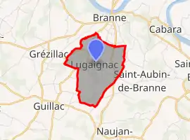 | |
 Lugaignac  Lugaignac | |
| Coordinates: 44°48′57″N 0°11′33″W | |
| Country | France |
| Region | Nouvelle-Aquitaine |
| Department | Gironde |
| Arrondissement | Libourne |
| Canton | Les Coteaux de Dordogne |
| Government | |
| • Mayor (2020–2026) | Jean-Claude Delfaut[1] |
| Area 1 | 3.66 km2 (1.41 sq mi) |
| Population | 496 |
| • Density | 140/km2 (350/sq mi) |
| Time zone | UTC+01:00 (CET) |
| • Summer (DST) | UTC+02:00 (CEST) |
| INSEE/Postal code | 33257 /33420 |
| Elevation | 10–89 m (33–292 ft) (avg. 60 m or 200 ft) |
| 1 French Land Register data, which excludes lakes, ponds, glaciers > 1 km2 (0.386 sq mi or 247 acres) and river estuaries. | |
Population
| Year | Pop. | ±% |
|---|---|---|
| 1962 | 242 | — |
| 1968 | 242 | +0.0% |
| 1975 | 240 | −0.8% |
| 1982 | 265 | +10.4% |
| 1990 | 290 | +9.4% |
| 1999 | 300 | +3.4% |
| 2008 | 372 | +24.0% |
See also
References
- "Répertoire national des élus: les maires". data.gouv.fr, Plateforme ouverte des données publiques françaises (in French). 2 December 2020.
- "Populations légales 2019". The National Institute of Statistics and Economic Studies. 29 December 2021.
| Wikimedia Commons has media related to Lugaignac. |
This article is issued from Wikipedia. The text is licensed under Creative Commons - Attribution - Sharealike. Additional terms may apply for the media files.