Le Chastang
Le Chastang is a commune in the Corrèze department in central France.
Le Chastang | |
|---|---|
.svg.png.webp) Coat of arms | |
Location of Le Chastang 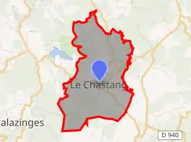 | |
 Le Chastang  Le Chastang | |
| Coordinates: 45°10′22″N 1°44′10″E | |
| Country | France |
| Region | Nouvelle-Aquitaine |
| Department | Corrèze |
| Arrondissement | Tulle |
| Canton | Sainte-Fortunade |
| Government | |
| • Mayor (2020–2026) | Florent Moussour[1] |
| Area 1 | 7.87 km2 (3.04 sq mi) |
| Population | 356 |
| • Density | 45/km2 (120/sq mi) |
| Time zone | UTC+01:00 (CET) |
| • Summer (DST) | UTC+02:00 (CEST) |
| INSEE/Postal code | 19048 /19190 |
| Elevation | 436–553 m (1,430–1,814 ft) (avg. 470 m or 1,540 ft) |
| 1 French Land Register data, which excludes lakes, ponds, glaciers > 1 km2 (0.386 sq mi or 247 acres) and river estuaries. | |
Population
| Year | Pop. | ±% |
|---|---|---|
| 1962 | 284 | — |
| 1968 | 251 | −11.6% |
| 1975 | 264 | +5.2% |
| 1982 | 288 | +9.1% |
| 1990 | 300 | +4.2% |
| 1999 | 308 | +2.7% |
| 2008 | 333 | +8.1% |
See also
References
- "Répertoire national des élus: les maires". data.gouv.fr, Plateforme ouverte des données publiques françaises (in French). 9 August 2021.
- "Populations légales 2019". The National Institute of Statistics and Economic Studies. 29 December 2021.
| Wikimedia Commons has media related to Le Chastang. |
This article is issued from Wikipedia. The text is licensed under Creative Commons - Attribution - Sharealike. Additional terms may apply for the media files.