Saint-Salvadour
Saint-Salvadour (French pronunciation: [sɛ̃ salvaduʁ]; Occitan: Sent Salvador) is a commune in the Corrèze department in central France.
Saint-Salvadour | |
|---|---|
 The church of Saint-Sauveur, in Saint-Salvadour | |
.svg.png.webp) Coat of arms | |
Location of Saint-Salvadour 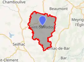 | |
 Saint-Salvadour  Saint-Salvadour | |
| Coordinates: 45°23′44″N 1°46′02″E | |
| Country | France |
| Region | Nouvelle-Aquitaine |
| Department | Corrèze |
| Arrondissement | Tulle |
| Canton | Seilhac-Monédières |
| Government | |
| • Mayor (2020–2026) | Pierre-Marie Capy |
| Area 1 | 19.47 km2 (7.52 sq mi) |
| Population | 290 |
| • Density | 15/km2 (39/sq mi) |
| Time zone | UTC+01:00 (CET) |
| • Summer (DST) | UTC+02:00 (CEST) |
| INSEE/Postal code | 19240 /19700 |
| Elevation | 305–528 m (1,001–1,732 ft) (avg. 425 m or 1,394 ft) |
| 1 French Land Register data, which excludes lakes, ponds, glaciers > 1 km2 (0.386 sq mi or 247 acres) and river estuaries. | |
Population
| Year | Pop. | ±% |
|---|---|---|
| 1962 | 374 | — |
| 1968 | 442 | +18.2% |
| 1975 | 356 | −19.5% |
| 1982 | 344 | −3.4% |
| 1990 | 292 | −15.1% |
| 1999 | 295 | +1.0% |
| 2008 | 292 | −1.0% |
See also
References
- "Populations légales 2019". The National Institute of Statistics and Economic Studies. 29 December 2021.
| Wikimedia Commons has media related to Saint-Salvadour. |
This article is issued from Wikipedia. The text is licensed under Creative Commons - Attribution - Sharealike. Additional terms may apply for the media files.