Étrappe
Étrappe (French pronunciation: [etʁap]) is a commune in the Doubs département in the Bourgogne-Franche-Comté region in eastern France.
Étrappe | |
|---|---|
 A general view of Étrappe | |
Location of Étrappe 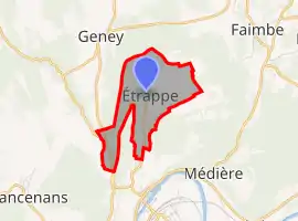 | |
 Étrappe  Étrappe | |
| Coordinates: 47°28′30″N 6°34′49″E | |
| Country | France |
| Region | Bourgogne-Franche-Comté |
| Department | Doubs |
| Arrondissement | Montbéliard |
| Canton | Bavans |
| Government | |
| • Mayor (2020–2026) | Bruno Baudrey[1] |
| Area 1 | 2.92 km2 (1.13 sq mi) |
| Population | 218 |
| • Density | 75/km2 (190/sq mi) |
| Time zone | UTC+01:00 (CET) |
| • Summer (DST) | UTC+02:00 (CEST) |
| INSEE/Postal code | 25226 /25250 |
| Elevation | 296–463 m (971–1,519 ft) |
| 1 French Land Register data, which excludes lakes, ponds, glaciers > 1 km2 (0.386 sq mi or 247 acres) and river estuaries. | |
Population
| Year | Pop. | ±% |
|---|---|---|
| 1962 | 62 | — |
| 1968 | 67 | +8.1% |
| 1975 | 100 | +49.3% |
| 1982 | 160 | +60.0% |
| 1990 | 165 | +3.1% |
| 1999 | 161 | −2.4% |
| 2008 | 180 | +11.8% |
| 2012 | 194 | +7.8% |
See also
References
- "Répertoire national des élus: les maires". data.gouv.fr, Plateforme ouverte des données publiques françaises (in French). 2 December 2020.
- "Populations légales 2019". The National Institute of Statistics and Economic Studies. 29 December 2021.
| Wikimedia Commons has media related to Étrappe. |
This article is issued from Wikipedia. The text is licensed under Creative Commons - Attribution - Sharealike. Additional terms may apply for the media files.