Champdôtre
Champdôtre (French pronunciation: [ʃɑ̃dotʁ]) is a commune in the Côte-d'Or department in eastern France.
Champdôtre | |
|---|---|
 Train station | |
.svg.png.webp) Coat of arms | |
Location of Champdôtre 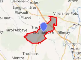 | |
 Champdôtre  Champdôtre | |
| Coordinates: 47°10′56″N 5°18′16″E | |
| Country | France |
| Region | Bourgogne-Franche-Comté |
| Department | Côte-d'Or |
| Arrondissement | Dijon |
| Canton | Auxonne |
| Government | |
| • Mayor (2020–2026) | Jean-Louis Laguerre[1] |
| Area 1 | 10.44 km2 (4.03 sq mi) |
| Population | 597 |
| • Density | 57/km2 (150/sq mi) |
| Time zone | UTC+01:00 (CET) |
| • Summer (DST) | UTC+02:00 (CEST) |
| INSEE/Postal code | 21138 /21130 |
| Elevation | 185–204 m (607–669 ft) (avg. 191 m or 627 ft) |
| 1 French Land Register data, which excludes lakes, ponds, glaciers > 1 km2 (0.386 sq mi or 247 acres) and river estuaries. | |
Population
| Year | Pop. | ±% |
|---|---|---|
| 1962 | 443 | — |
| 1968 | 482 | +8.8% |
| 1975 | 452 | −6.2% |
| 1982 | 474 | +4.9% |
| 1990 | 504 | +6.3% |
| 1999 | 548 | +8.7% |
| 2008 | 549 | +0.2% |
See also
References
- "Répertoire national des élus: les maires". data.gouv.fr, Plateforme ouverte des données publiques françaises (in French). 2 December 2020.
- "Populations légales 2019". The National Institute of Statistics and Economic Studies. 29 December 2021.
| Wikimedia Commons has media related to Champdôtre. |
This article is issued from Wikipedia. The text is licensed under Creative Commons - Attribution - Sharealike. Additional terms may apply for the media files.