Courcelles-lès-Montbard
Courcelles-lès-Montbard (French pronunciation: [kuʁsɛl lɛ mɔ̃baʁ], literally Courcelles near Montbard) is a commune in the Côte-d'Or department in eastern France.
Courcelles-lès-Montbard | |
|---|---|
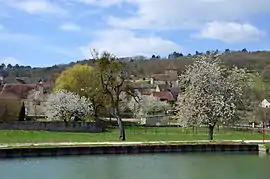 A general view of Courcelles-lès-Montbard | |
Location of Courcelles-lès-Montbard  | |
 Courcelles-lès-Montbard  Courcelles-lès-Montbard | |
| Coordinates: 47°35′40″N 4°23′54″E | |
| Country | France |
| Region | Bourgogne-Franche-Comté |
| Department | Côte-d'Or |
| Arrondissement | Montbard |
| Canton | Montbard |
| Government | |
| • Mayor (2020–2026) | Yacim Hadine[1] |
| Area 1 | 6.12 km2 (2.36 sq mi) |
| Population | 86 |
| • Density | 14/km2 (36/sq mi) |
| Time zone | UTC+01:00 (CET) |
| • Summer (DST) | UTC+02:00 (CEST) |
| INSEE/Postal code | 21204 /21500 |
| Elevation | 214–375 m (702–1,230 ft) (avg. 260 m or 850 ft) |
| 1 French Land Register data, which excludes lakes, ponds, glaciers > 1 km2 (0.386 sq mi or 247 acres) and river estuaries. | |
Population
| Year | Pop. | ±% |
|---|---|---|
| 1962 | 108 | — |
| 1968 | 117 | +8.3% |
| 1975 | 92 | −21.4% |
| 1982 | 79 | −14.1% |
| 1990 | 116 | +46.8% |
| 1999 | 102 | −12.1% |
| 2008 | 90 | −11.8% |
See also
References
- "Répertoire national des élus: les maires". data.gouv.fr, Plateforme ouverte des données publiques françaises (in French). 2 December 2020.
- "Populations légales 2019". The National Institute of Statistics and Economic Studies. 29 December 2021.
| Wikimedia Commons has media related to Courcelles-lès-Montbard. |
This article is issued from Wikipedia. The text is licensed under Creative Commons - Attribution - Sharealike. Additional terms may apply for the media files.