Gomméville
Gomméville (French pronunciation: [ɡɔmevil]) is a commune in the Côte-d'Or department in eastern France.
Gomméville | |
|---|---|
.jpg.webp) Bridge over the Seine | |
.svg.png.webp) Coat of arms | |
Location of Gomméville 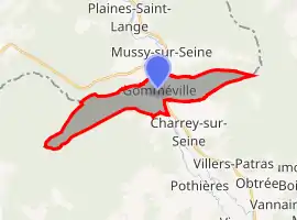 | |
 Gomméville  Gomméville | |
| Coordinates: 47°57′42″N 4°29′44″E | |
| Country | France |
| Region | Bourgogne-Franche-Comté |
| Department | Côte-d'Or |
| Arrondissement | Montbard |
| Canton | Châtillon-sur-Seine |
| Intercommunality | Pays Châtillonnais |
| Government | |
| • Mayor (2020–2026) | Jean-Paul Rommel |
| Area 1 | 9.83 km2 (3.80 sq mi) |
| Population | 124 |
| • Density | 13/km2 (33/sq mi) |
| Time zone | UTC+01:00 (CET) |
| • Summer (DST) | UTC+02:00 (CEST) |
| INSEE/Postal code | 21302 /21400 |
| Elevation | 189–355 m (620–1,165 ft) (avg. 193 m or 633 ft) |
| 1 French Land Register data, which excludes lakes, ponds, glaciers > 1 km2 (0.386 sq mi or 247 acres) and river estuaries. | |
Population
| Year | Pop. | ±% |
|---|---|---|
| 1962 | 186 | — |
| 1968 | 198 | +6.5% |
| 1975 | 194 | −2.0% |
| 1982 | 161 | −17.0% |
| 1990 | 142 | −11.8% |
| 1999 | 132 | −7.0% |
| 2008 | 148 | +12.1% |
See also
References
- "Populations légales 2019". The National Institute of Statistics and Economic Studies. 29 December 2021.
| Wikimedia Commons has media related to Gomméville. |
Authority control | |
|---|---|
| General | |
| National libraries | |
This article is issued from Wikipedia. The text is licensed under Creative Commons - Attribution - Sharealike. Additional terms may apply for the media files.