Chaum
Chaum is a commune in the Haute-Garonne department in southwestern France.
Chaum | |
|---|---|
 The town hall in Chaum | |
.svg.png.webp) Coat of arms | |
Location of Chaum 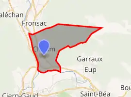 | |
 Chaum  Chaum | |
| Coordinates: 42°56′07″N 0°39′22″E | |
| Country | France |
| Region | Occitania |
| Department | Haute-Garonne |
| Arrondissement | Saint-Gaudens |
| Canton | Bagnères-de-Luchon |
| Intercommunality | Pyrénées Haut Garonnaises |
| Government | |
| • Mayor (2020–2026) | Joseph Castell[1] |
| Area 1 | 5.7 km2 (2.2 sq mi) |
| Population | 195 |
| • Density | 34/km2 (89/sq mi) |
| Time zone | UTC+01:00 (CET) |
| • Summer (DST) | UTC+02:00 (CEST) |
| INSEE/Postal code | 31139 /31440 |
| Elevation | 468–1,680 m (1,535–5,512 ft) (avg. 475 m or 1,558 ft) |
| 1 French Land Register data, which excludes lakes, ponds, glaciers > 1 km2 (0.386 sq mi or 247 acres) and river estuaries. | |
It is situated on the former Route nationale 618, the "Route of the Pyrenees".
Population
| Year | Pop. | ±% |
|---|---|---|
| 1962 | 220 | — |
| 1968 | 255 | +15.9% |
| 1975 | 247 | −3.1% |
| 1982 | 212 | −14.2% |
| 1990 | 198 | −6.6% |
| 1999 | 193 | −2.5% |
| 2008 | 209 | +8.3% |
| 2018 | 192 | −8.1% |
References
- "Répertoire national des élus: les maires". data.gouv.fr, Plateforme ouverte des données publiques françaises (in French). 2 December 2020.
- "Populations légales 2019". The National Institute of Statistics and Economic Studies. 29 December 2021.
| Wikimedia Commons has media related to Chaum. |
This article is issued from Wikipedia. The text is licensed under Creative Commons - Attribution - Sharealike. Additional terms may apply for the media files.