Rouède
Rouède (French pronunciation: [ʁwɛd]; Occitan: Arrueda) is a commune in the Haute-Garonne department in southwestern France.
Rouède | |
|---|---|
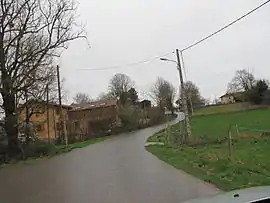 The road into Rouède | |
Location of Rouède  | |
 Rouède  Rouède | |
| Coordinates: 43°03′13″N 0°52′56″E | |
| Country | France |
| Region | Occitania |
| Department | Haute-Garonne |
| Arrondissement | Saint-Gaudens |
| Canton | Bagnères-de-Luchon |
| Intercommunality | Cagire Garonne Salat |
| Government | |
| • Mayor (2020–2026) | André Casteras[1] |
| Area 1 | 6.2 km2 (2.4 sq mi) |
| Population | 289 |
| • Density | 47/km2 (120/sq mi) |
| Time zone | UTC+01:00 (CET) |
| • Summer (DST) | UTC+02:00 (CEST) |
| INSEE/Postal code | 31461 /31160 |
| Elevation | 356–489 m (1,168–1,604 ft) (avg. 400 m or 1,300 ft) |
| 1 French Land Register data, which excludes lakes, ponds, glaciers > 1 km2 (0.386 sq mi or 247 acres) and river estuaries. | |
Population
| Year | Pop. | ±% |
|---|---|---|
| 1962 | 256 | — |
| 1968 | 267 | +4.3% |
| 1975 | 248 | −7.1% |
| 1982 | 221 | −10.9% |
| 1990 | 227 | +2.7% |
| 1999 | 236 | +4.0% |
| 2008 | 281 | +19.1% |
References
- "Répertoire national des élus: les maires". data.gouv.fr, Plateforme ouverte des données publiques françaises (in French). 2 December 2020.
- "Populations légales 2019". The National Institute of Statistics and Economic Studies. 29 December 2021.
| Wikimedia Commons has media related to Rouède. |
This article is issued from Wikipedia. The text is licensed under Creative Commons - Attribution - Sharealike. Additional terms may apply for the media files.