Larcan
Larcan (French pronunciation: [laʁkɑ̃]) is a commune in the Haute-Garonne department in southwestern France.
Larcan | |
|---|---|
Location of Larcan 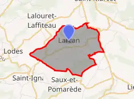 | |
 Larcan  Larcan | |
| Coordinates: 43°10′36″N 0°43′17″E | |
| Country | France |
| Region | Occitania |
| Department | Haute-Garonne |
| Arrondissement | Saint-Gaudens |
| Canton | Saint-Gaudens |
| Government | |
| • Mayor (2020–2026) | Henri Fourment[1] |
| Area 1 | 6.96 km2 (2.69 sq mi) |
| Population | 182 |
| • Density | 26/km2 (68/sq mi) |
| Time zone | UTC+01:00 (CET) |
| • Summer (DST) | UTC+02:00 (CEST) |
| INSEE/Postal code | 31274 /31800 |
| Elevation | 349–450 m (1,145–1,476 ft) (avg. 435 m or 1,427 ft) |
| 1 French Land Register data, which excludes lakes, ponds, glaciers > 1 km2 (0.386 sq mi or 247 acres) and river estuaries. | |
Population
| Year | Pop. | ±% |
|---|---|---|
| 1962 | 149 | — |
| 1968 | 164 | +10.1% |
| 1975 | 169 | +3.0% |
| 1982 | 168 | −0.6% |
| 1990 | 147 | −12.5% |
| 1999 | 156 | +6.1% |
| 2008 | 177 | +13.5% |
References
- "Répertoire national des élus: les maires". data.gouv.fr, Plateforme ouverte des données publiques françaises (in French). 9 August 2021.
- "Populations légales 2019". The National Institute of Statistics and Economic Studies. 29 December 2021.
| Wikimedia Commons has media related to Larcan. |
This article is issued from Wikipedia. The text is licensed under Creative Commons - Attribution - Sharealike. Additional terms may apply for the media files.