Ferrals-les-Montagnes
Ferrals-les-Montagnes (French pronunciation: [fɛʁal le mɔ̃taɲ]; Occitan: Ferrals de las Montanhas) is a commune in the Hérault department in southern France.

Map
Ferrals-les-Montagnes | |
|---|---|
.svg.png.webp) Coat of arms | |
Location of Ferrals-les-Montagnes 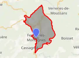 | |
 Ferrals-les-Montagnes  Ferrals-les-Montagnes | |
| Coordinates: 43°24′11″N 2°37′55″E | |
| Country | France |
| Region | Occitania |
| Department | Hérault |
| Arrondissement | Béziers |
| Canton | Saint-Pons-de-Thomières |
| Government | |
| • Mayor (2020–2026) | Daniel Piva[1] |
| Area 1 | 25.78 km2 (9.95 sq mi) |
| Population | 153 |
| • Density | 5.9/km2 (15/sq mi) |
| Demonym(s) | Ferralais |
| Time zone | UTC+01:00 (CET) |
| • Summer (DST) | UTC+02:00 (CEST) |
| INSEE/Postal code | 34098 /34210 |
| Elevation | 358–887 m (1,175–2,910 ft) (avg. 400 m or 1,300 ft) |
| 1 French Land Register data, which excludes lakes, ponds, glaciers > 1 km2 (0.386 sq mi or 247 acres) and river estuaries. | |
Population
| Year | Pop. | ±% |
|---|---|---|
| 1962 | 83 | — |
| 1968 | 135 | +62.7% |
| 1975 | 117 | −13.3% |
| 1982 | 143 | +22.2% |
| 1990 | 112 | −21.7% |
| 1999 | 140 | +25.0% |
| 2008 | 153 | +9.3% |
See also
References
- "Répertoire national des élus: les maires". data.gouv.fr, Plateforme ouverte des données publiques françaises (in French). 2 December 2020.
- "Populations légales 2019". The National Institute of Statistics and Economic Studies. 29 December 2021.
| Wikimedia Commons has media related to Ferrals-les-Montagnes. |
This article is issued from Wikipedia. The text is licensed under Creative Commons - Attribution - Sharealike. Additional terms may apply for the media files.