Vendargues
Vendargues is a commune in the Hérault department in the Occitanie region in southern France.
Vendargues | |
|---|---|
 An aerial view of Vendargues | |
.svg.png.webp) Coat of arms | |
Location of Vendargues 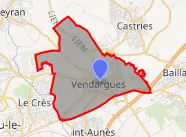 | |
 Vendargues  Vendargues | |
| Coordinates: 43°39′30″N 3°58′12″E | |
| Country | France |
| Region | Occitania |
| Department | Hérault |
| Arrondissement | Montpellier |
| Canton | Le Crès |
| Intercommunality | Montpellier Méditerranée Métropole |
| Government | |
| • Mayor (2020–2026) | Guy Lauret[1] |
| Area 1 | 8.98 km2 (3.47 sq mi) |
| Population | 6,423 |
| • Density | 720/km2 (1,900/sq mi) |
| Time zone | UTC+01:00 (CET) |
| • Summer (DST) | UTC+02:00 (CEST) |
| INSEE/Postal code | 34327 /34740 |
| Elevation | 25–86 m (82–282 ft) |
| 1 French Land Register data, which excludes lakes, ponds, glaciers > 1 km2 (0.386 sq mi or 247 acres) and river estuaries. | |
Population
| Year | Pop. | ±% |
|---|---|---|
| 1962 | 1,196 | — |
| 1968 | 1,411 | +18.0% |
| 1975 | 1,871 | +32.6% |
| 1982 | 2,601 | +39.0% |
| 1990 | 4,257 | +63.7% |
| 1999 | 5,228 | +22.8% |
| 2008 | 5,491 | +5.0% |
See also
References
- "Répertoire national des élus: les maires". data.gouv.fr, Plateforme ouverte des données publiques françaises (in French). 9 August 2021.
- "Populations légales 2019". The National Institute of Statistics and Economic Studies. 29 December 2021.
| Wikimedia Commons has media related to Vendargues. |
This article is issued from Wikipedia. The text is licensed under Creative Commons - Attribution - Sharealike. Additional terms may apply for the media files.