Tourbes
Tourbes is a commune in the Hérault department in the Occitanie region in southern France.
Tourbes | |
|---|---|
 The church of Tourbes | |
.svg.png.webp) Coat of arms | |
Location of Tourbes 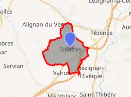 | |
 Tourbes  Tourbes | |
| Coordinates: 43°26′48″N 3°22′46″E | |
| Country | France |
| Region | Occitania |
| Department | Hérault |
| Arrondissement | Béziers |
| Canton | Pézenas |
| Government | |
| • Mayor (2020–2026) | Lionel Puche[1] |
| Area 1 | 15.96 km2 (6.16 sq mi) |
| Population | 1,719 |
| • Density | 110/km2 (280/sq mi) |
| Time zone | UTC+01:00 (CET) |
| • Summer (DST) | UTC+02:00 (CEST) |
| INSEE/Postal code | 34311 /34120 |
| Elevation | 11–103 m (36–338 ft) (avg. 50 m or 160 ft) |
| 1 French Land Register data, which excludes lakes, ponds, glaciers > 1 km2 (0.386 sq mi or 247 acres) and river estuaries. | |
Population
| Year | Pop. | ±% |
|---|---|---|
| 1962 | 766 | — |
| 1968 | 767 | +0.1% |
| 1975 | 740 | −3.5% |
| 1982 | 833 | +12.6% |
| 1990 | 1,022 | +22.7% |
| 1999 | 1,276 | +24.9% |
| 2008 | 1,462 | +14.6% |
See also
References
- "Répertoire national des élus: les maires". data.gouv.fr, Plateforme ouverte des données publiques françaises (in French). 9 August 2021.
- "Populations légales 2019". The National Institute of Statistics and Economic Studies. 29 December 2021.
| Wikimedia Commons has media related to Tourbes. |
This article is issued from Wikipedia. The text is licensed under Creative Commons - Attribution - Sharealike. Additional terms may apply for the media files.