Rocquigny, Ardennes
Rocquigny is a commune in the Ardennes department in northern France.
Rocquigny | |
|---|---|
_%C3%89glise_fortifi%C3%A9e.JPG.webp) Fortified church | |
 Coat of arms | |
Location of Rocquigny 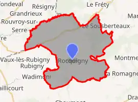 | |
 Rocquigny  Rocquigny | |
| Coordinates: 49°41′28″N 4°14′54″E | |
| Country | France |
| Region | Grand Est |
| Department | Ardennes |
| Arrondissement | Rethel |
| Canton | Signy-l'Abbaye |
| Intercommunality | Crêtes Préardennaises |
| Government | |
| • Mayor (2020–2026) | Serge Labie[1] |
| Area 1 | 36.85 km2 (14.23 sq mi) |
| Population | 682 |
| • Density | 19/km2 (48/sq mi) |
| Time zone | UTC+01:00 (CET) |
| • Summer (DST) | UTC+02:00 (CEST) |
| INSEE/Postal code | 08366 /08220 |
| 1 French Land Register data, which excludes lakes, ponds, glaciers > 1 km2 (0.386 sq mi or 247 acres) and river estuaries. | |
Population
| Year | Pop. | ±% |
|---|---|---|
| 1962 | 1,020 | — |
| 1968 | 1,037 | +1.7% |
| 1975 | 896 | −13.6% |
| 1982 | 854 | −4.7% |
| 1990 | 775 | −9.3% |
| 1999 | 755 | −2.6% |
| 2008 | 754 | −0.1% |
See also
References
- "Répertoire national des élus: les maires". data.gouv.fr, Plateforme ouverte des données publiques françaises (in French). 2 December 2020.
- "Populations légales 2019". The National Institute of Statistics and Economic Studies. 29 December 2021.
| Wikimedia Commons has media related to Rocquigny, Ardennes. |
This article is issued from Wikipedia. The text is licensed under Creative Commons - Attribution - Sharealike. Additional terms may apply for the media files.