Montéléger
Montéléger (French pronunciation: [mɔ̃teleʒe]; Occitan: Montalagier) is a commune in the Drôme department in southeastern France.
Montéléger | |
|---|---|
 Chateau | |
.svg.png.webp) Coat of arms | |
Location of Montéléger 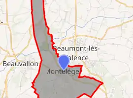 | |
 Montéléger  Montéléger | |
| Coordinates: 44°51′15″N 4°56′02″E | |
| Country | France |
| Region | Auvergne-Rhône-Alpes |
| Department | Drôme |
| Arrondissement | Valence |
| Canton | Valence-3 |
| Intercommunality | CA Valence Romans Agglo |
| Government | |
| • Mayor (2020–2026) | Marylène Peyrard[1] |
| Area 1 | 9.45 km2 (3.65 sq mi) |
| Population | 1,796 |
| • Density | 190/km2 (490/sq mi) |
| Time zone | UTC+01:00 (CET) |
| • Summer (DST) | UTC+02:00 (CEST) |
| INSEE/Postal code | 26196 /26760 |
| Elevation | 129–222 m (423–728 ft) (avg. 109 m or 358 ft) |
| 1 French Land Register data, which excludes lakes, ponds, glaciers > 1 km2 (0.386 sq mi or 247 acres) and river estuaries. | |
Population
| Year | Pop. | ±% |
|---|---|---|
| 1911 | 1,400 | — |
| 1962 | 455 | −67.5% |
| 1968 | 580 | +27.5% |
| 1975 | 941 | +62.2% |
| 1982 | 1,432 | +52.2% |
| 1990 | 1,399 | −2.3% |
| 1999 | 1,526 | +9.1% |
| 2008 | 1,900 | +24.5% |
See also
References
- "Répertoire national des élus: les maires". data.gouv.fr, Plateforme ouverte des données publiques françaises (in French). 2 December 2020.
- "Populations légales 2019". The National Institute of Statistics and Economic Studies. 29 December 2021.
| Wikimedia Commons has media related to Montéléger. |
This article is issued from Wikipedia. The text is licensed under Creative Commons - Attribution - Sharealike. Additional terms may apply for the media files.