Saint-Privat-de-Champclos
Saint-Privat-de-Champclos is a commune in the Gard department in southern France.
Saint-Privat-de-Champclos | |
|---|---|
 A general view of Saint-Privat-de-Champclos | |
.svg.png.webp) Coat of arms | |
Location of Saint-Privat-de-Champclos 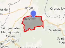 | |
 Saint-Privat-de-Champclos  Saint-Privat-de-Champclos | |
| Coordinates: 44°17′09″N 4°21′31″E | |
| Country | France |
| Region | Occitania |
| Department | Gard |
| Arrondissement | Alès |
| Canton | Rousson |
| Government | |
| • Mayor (2020–2026) | Jean-François Flandin[1] |
| Area 1 | 11.64 km2 (4.49 sq mi) |
| Population | 349 |
| • Density | 30/km2 (78/sq mi) |
| Time zone | UTC+01:00 (CET) |
| • Summer (DST) | UTC+02:00 (CEST) |
| INSEE/Postal code | 30293 /30430 |
| Elevation | 90–279 m (295–915 ft) (avg. 250 m or 820 ft) |
| 1 French Land Register data, which excludes lakes, ponds, glaciers > 1 km2 (0.386 sq mi or 247 acres) and river estuaries. | |
Population
| Year | Pop. | ±% |
|---|---|---|
| 1793 | 506 | — |
| 1821 | 496 | −2.0% |
| 1846 | 602 | +21.4% |
| 1872 | 540 | −10.3% |
| 1901 | 390 | −27.8% |
| 1926 | 289 | −25.9% |
| 1946 | 247 | −14.5% |
| 1962 | 136 | −44.9% |
| 1968 | 173 | +27.2% |
| 1975 | 173 | +0.0% |
| 1982 | 189 | +9.2% |
| 1990 | 212 | +12.2% |
| 1999 | 203 | −4.2% |
| 2008 | 305 | +50.2% |
References
- "Répertoire national des élus: les maires". data.gouv.fr, Plateforme ouverte des données publiques françaises (in French). 9 August 2021.
- "Populations légales 2019". The National Institute of Statistics and Economic Studies. 29 December 2021.
| Wikimedia Commons has media related to Saint-Privat-de-Champclos. |
This article is issued from Wikipedia. The text is licensed under Creative Commons - Attribution - Sharealike. Additional terms may apply for the media files.