Sernhac
Sernhac is a commune in the Gard department in southern France.
Sernhac | |
|---|---|
 The church of Saint-Sauveur in Sernhac | |
.svg.png.webp) Coat of arms | |
Location of Sernhac 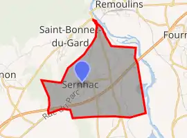 | |
 Sernhac  Sernhac | |
| Coordinates: 43°54′44″N 4°33′10″E | |
| Country | France |
| Region | Occitania |
| Department | Gard |
| Arrondissement | Nîmes |
| Canton | Redessan |
| Intercommunality | CA Nîmes Métropole |
| Government | |
| • Mayor (2020–2026) | Gaël Dupret[1] |
| Area 1 | 8.93 km2 (3.45 sq mi) |
| Population | 1,765 |
| • Density | 200/km2 (510/sq mi) |
| Time zone | UTC+01:00 (CET) |
| • Summer (DST) | UTC+02:00 (CEST) |
| INSEE/Postal code | 30317 /30210 |
| Elevation | 12–155 m (39–509 ft) (avg. 50 m or 160 ft) |
| 1 French Land Register data, which excludes lakes, ponds, glaciers > 1 km2 (0.386 sq mi or 247 acres) and river estuaries. | |
Population
| Year | Pop. | ±% |
|---|---|---|
| 1962 | 886 | — |
| 1968 | 903 | +1.9% |
| 1975 | 870 | −3.7% |
| 1982 | 899 | +3.3% |
| 1990 | 1,155 | +28.5% |
| 1999 | 1,226 | +6.1% |
| 2008 | 1,513 | +23.4% |
References
- "Répertoire national des élus: les maires". data.gouv.fr, Plateforme ouverte des données publiques françaises (in French). 2 December 2020. Retrieved 7 December 2020.
- "Populations légales 2019". The National Institute of Statistics and Economic Studies. 29 December 2021.
| Wikimedia Commons has media related to Sernhac. |
This article is issued from Wikipedia. The text is licensed under Creative Commons - Attribution - Sharealike. Additional terms may apply for the media files.